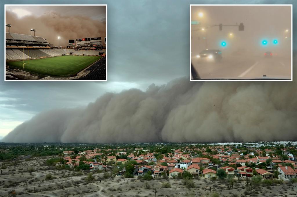
An epic dust storm, known as a haboob, swept across the Phoenix area in Arizona on Monday, knocking out power to thousands of utility customers and causing travel chaos as damaging winds ripped across the region.
The intense situation began to unfold on Monday as monsoon storms rolled across portions of Arizona, producing heavy rain and thunderstorms.
According to the Gilbert Police Department, the powerful storms knocked down trees and power lines, prompting officials to ask people to avoid travel until crews could clear debris from the roadways.
“If you must travel, please drive with caution as we are working diligently to restore lights and clear roadways,” police said in a post on X.
The dust storm also led to travel problems at Phoenix Sky Harbor International Airport, with officials issuing a ground stop for flights arriving and departing for safety.
That ground stop has since been lifted.
Dust Storm Warnings were issued in Arizona on Monday, including the Phoenix area, causing chaos on Interstate 10 as visibility quickly dropped to zero.
There were also reports of damage as winds gusted to 60 mph at Phoenix Sky Harbor International Airport and 66 mph near East Mesa.
There were also reports of a roof being torn off a home near Marana, Arizona.
Outside the dust storm, thunderstorms were reported in Phoenix and Tucson.
Phoenix saw its second-wettest day of 2025, but is still experiencing its 10th-driest start to any year, while Tucson is experiencing its third-driest year to date.
Both cities’ records go back to 1895.
More monsoon storms on the way
“The Southwest? Guess what. Monsoon is in full swing,” FOX Weather Meteorologist Britta Merwin said. “A little bit of a slow onset, but we’re feeling it. And it has been bone dry in Arizona.”
The FOX Forecast Center said a ridge of high pressure shifted toward the Four Corners region over the weekend, and a surge of monsoonal moisture has been pushing through the area.
The rainfall is beneficial as all of Arizona is in a drought.
More precipitation and thunderstorms are on the way, and fears are growing that flash flooding could occur due to intense rainfall rates of 1-1.5 inches an hour.
Flood-prone areas, including in canyons and burn-scar areas, should remain alert to potential flooding.
In fact, NOAA’s Weather Prediction Center (WPC) has placed portions of southern Arizona in a Level 2 out of 4 flash flood risk on Tuesday.
Read the full article here
