
A late-season burst of winter weather is set to hit parts of Montana, with the National Weather Service (NWS) warning that up to 5 inches of wet snow and powerful wind gusts exceeding 60 mph could create hazardous conditions across Glacier National Park and surrounding areas.
The combination of snow, wind and dropping temperatures is expected to make travel difficult, particularly at higher elevations, while also posing a serious hypothermia risk for anyone caught outdoors. Slushy roads, reduced visibility, and falling branches could further disrupt travel and recreation.
Montana Winter Weather: Who Is Most Affected?
The latest NWS advisories cover Glacier National Park and the East and West Glacier regions, with conditions expected to worsen overnight Wednesday into Thursday.
The most significant impacts will be felt above 5,000 to 5,500 feet, where a mix of wet, heavy snowfall and strong winds will create dangerous conditions.
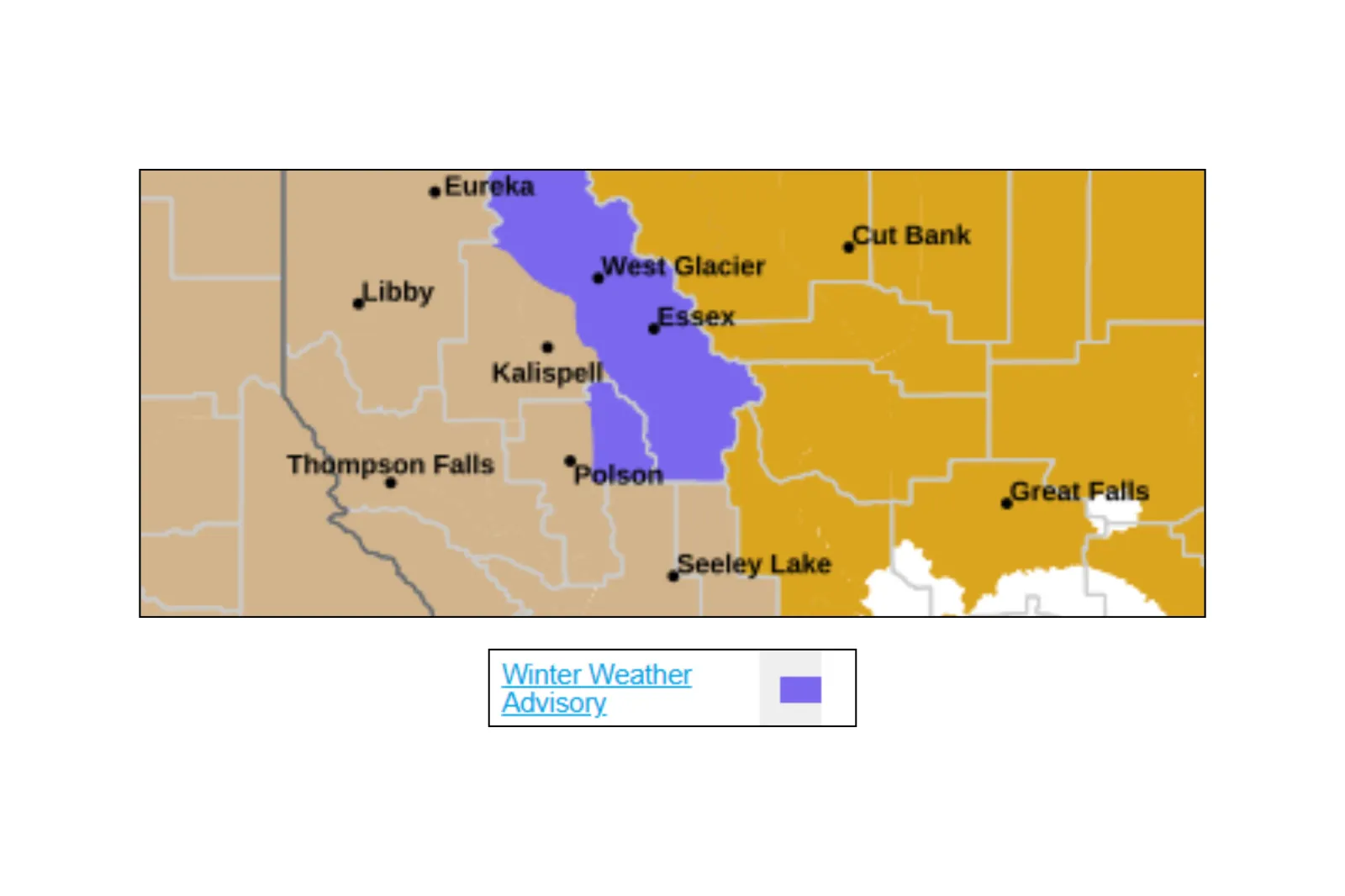
Areas highlighted in the advisory include:
- East Glacier Park region, including Kiowa, Marias Pass, Saint Mary, and Logan Pass
- West Glacier region, covering much of Glacier National Park
How Much Snow Is Expected?
The NWS is predicting that snow totals will generally range from 2 to 6 inches, with the highest accumulations expected in elevated terrain. Winds could also gust between 50 mph and 60 mph, intensifying the risk of falling branches and sharply reducing visibility.
Although snowfall totals will vary, the NWS has outlined the following expectations:
- Logan Pass and areas above 5,500 feet: Up to 6 inches of wet snow
- Higher elevations across Glacier National Park (above 5,000 feet): Around 2 to 5 inches
- Lower elevations: Less accumulation, though slippery, slushy conditions are still possible
Because the snow will be wet and heavy, it is more likely to stick to surfaces, including tree branches and roadways. Combined with strong winds, this increases the chance of debris falling and localized hazards.
Snow Warnings: What Should Drivers Expect?
Drivers heading through or near Glacier National Park should be prepared for rapidly deteriorating travel conditions, particularly overnight Wednesday and into Thursday morning.
Key travel concerns include:
- Slushy, snow-covered roads at higher elevations
- Reduced visibility due to blowing snow and strong wind gusts
- Hazardous mountain passes, especially Logan and Marias Passes
- Potential for downed tree branches, blocking roadways
While no widespread highway closures have been announced at the time of publishing, mountain routes in and around the park are likely to be the most hazardous. Drivers should exercise caution and slow down, allow extra travel time, and carry emergency supplies if they’re traveling through elevated terrain.
Local Impacts: Outdoor Safety and Disruptions
Although widespread school closures are unlikely in lower-lying communities, the weather could significantly impact tourism and outdoor recreation in Glacier National Park.
The NWS is emphasizing the risk of hypothermia, particularly for hikers, campers, and anyone caught unprepared in the backcountry. Wet snow combined with gusty winds can quickly strip body heat, even in May.
Even a few inches of snow, when paired with strong winds and cold temperatures, can turn dangerous quickly—especially in mountainous terrain.
Officials are, therefore, recommending that anyone planning to travel or be outside should:
- Dress in warm, waterproof layers
- Monitor local weather updates for any updates
- Avoid unnecessary travel, especially through high-elevation routes
- Be prepared for rapidly changing conditions
Read the full article here