

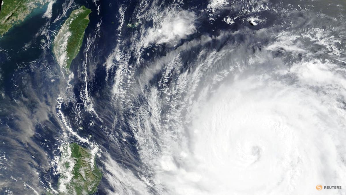
BEIJING: China and Taiwan were bracing for possibly the most destructive tropical storm in years as Typhoon Bavi churned southeast of Taiwan on Thursday (Jul 9), with winds near 200kmh, and as parts of China were still reeling from Typhoon Maysak.
Authorities in Taiwan forecast that up to 1m of rain will hit the island’s northern mountains around Taipei and some 29,000 soldiers have been placed on standby, the defence ministry said, as it braces for what could be its most powerful typhoon since Kong-rey in 2024, which killed three people.
Bavi, currently about 1,000km at its widest point or roughly the width of France, is forecast to skirt northern Taiwan before making landfall in China’s eastern Fujian province on Saturday evening, according to China’s National Meteorological Centre.
Storms of this size have been “fairly rare in recent years”, Jason Chang, Taiwan’s Central Weather Administration forecaster, told Reuters, adding that Bavi is set to be the largest storm by size to hit the island since 1987.
Rescue workers in China were still combing through wreckage left by Typhoon Maysak, which killed at least 39 people as it swept through the southwestern region of Guangxi earlier this week, local officials told a news conference on Thursday. Nine people remained missing across the region, they added.
China, the world’s second-largest economy, along with neighbouring Japan and Taiwan, are increasingly exposed to destructive weather events that scientists link to climate change. This year is of particular concern because the expected emergence of El Nino could drive up temperatures and help fuel more frequent and intense typhoons.
“Some loss of wind intensity is anticipated starting Thursday, but Bavi will remain a dangerous storm as it impacts Taiwan and eastern China later Friday into Monday,” according to Jason Nicholls, an expert at AccuWeather, a commercial forecasting service.
Read the full article here
