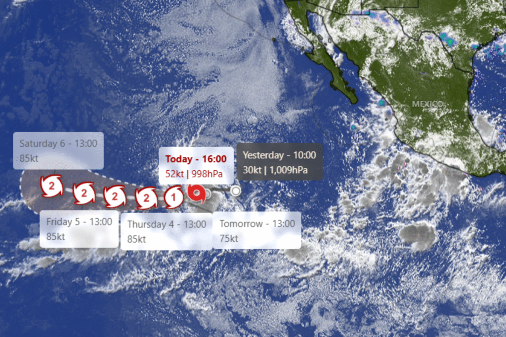
Tropical Storm Kiko has formed in the eastern Pacific, set to become a hurricane by Tuesday – Newsweek has rounded up everything you need to know.
Kiko is not expected to become a threat to land, the National Hurricane Center has said. No coastal watches or warnings have been issued.
Why It Matters
While the storm remains far from land, meteorologists are closely monitoring its potential to strengthen into a hurricane and shift course in the coming days.
Forecasters have said that conditions outside the cone of uncertainty—used to illustrate the likely path of the storm center—may still pose hazards.
Newsweek has contacted the National Hurricane Center (NHC) via email for comment.
What To Know
As of late Sunday, Kiko was located about 1,185 miles west-southwest of the southern tip of Baja California, according to the NHC.
The system was moving west at roughly 8 mph with maximum sustained winds of 45 mph. The agency forecast that Kiko could become a hurricane by Tuesday.
“Strengthening is expected during the next couple of days,” before the storm becomes a hurricane, the NHC said.
Kiko is the 11th named system in the Eastern North Pacific this year.
A few weeks ago, the National Oceanic and Atmospheric Administration (NOAA) updated the updated the number of expected named storms to 13-18 (winds of 39 mph or greater), of which 5-9 could become hurricanes (winds of 74 mph or greater), including 2-5 major hurricanes (winds of 111 mph or greater) throughout the hurricane season between June 1 and November 30.
What People Are Saying
The National Hurricane Center Miami said: “Kiko has intensified overnight and remains a compact storm.” It added: “Despite somewhat drier mid-level conditions along its forecast track, the combination of light vertical wind shear, warm sea surface temperatures, and Kiko’s small compact core should allow for strengthening in the short term.”
Acting NOAA Administrator Laura Grimm said at the beginning of August: “NOAA stands ready to provide the forecasts and warnings that are vital for safeguarding lives, property, and communities. As we enter the second half of the season, this updated hurricane outlook serves as a call to action to prepare now, in advance, rather than delay until a warning is issued.”
NOAA’s National Weather Service Director Ken Graham said: “No two storms are alike. “Every storm presents unique, life-threatening hazards that can impact people in both coastal and inland communities. Have a plan in place, and know the actions you should take before, during and after the wide range of hazards that the hurricane season can bring.”
What Happens Next
The next key milestone will be whether Kiko strengthens into a Category 1 hurricane by Tuesday, as forecast.
Ocean users, including shipping interests and residents of Hawaii and the eastern Pacific, are advised to remain informed through official channels like the NHC and local weather services.
The Pacific hurricane season runs through November 30.
Read the full article here
