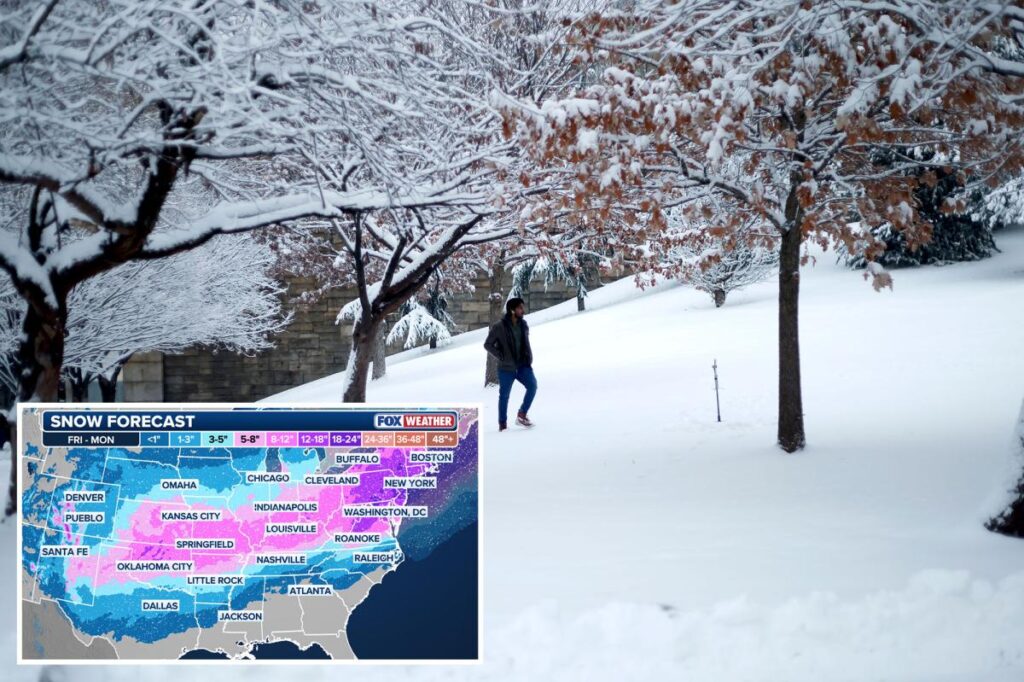
The Big Apple’s gonna be buried!
A fast-approaching massive storm is expected to dump as much as 16 inches of snow on New York City beginning as early as Saturday night — potentially the most in years, forecasters said Thursday.
A total of 8 to 16 inches will fall in the region, including in the Hudson Valley, nearly all of New Jersey and Connecticut, according to meteorologists cited by NBC New York.
If the Big Apple gets a foot of snow, it would mark the most in the city since February 2021, when 16.8 inches fell in Central Park over a two-day period.
Still, despite the warnings, Mayor Zohran Mamdani said the jury is still out on just how badly the city will be hit.
“We are expecting precipitation to begin late Saturday or early Sunday and to possibly last into Monday. The forecast is predicting anywhere from 3 to 12 inches of snow,” Mamdani said at a press conference Thursday.
“It is entirely possible that we get less than three inches — and it is just as possible that we get over a foot,” he said. “New Yorkers know that forecasts do not always get it right.”
He said the city will begin a “pre-snow treatment” on Friday to prepare for the storm.
“What that means is that we will brine all highways, major streets, and bike lanes to mitigate snow and ice accumulation, and we are also going to accelerate cleanup once the storm has passed,” he said.
He added that “roughly 2,000 sanitation workers” will work 12-hour shifts Saturday to “remove snow around the clock.”
“ As we speak, our sanitation fleet is being transformed into a snow-clearing fleet,” he said.
As of Thursday morning, forecasters predicted many hours of snowfall lasting until at least Monday morning.
In the Hudson Valley, one local weather expert predicted up to 2 feet of snow — the most in 30 years, according to the Hudson Valley News.
Forecaster Ben Noll said there was roughly a 100 percent chance of 6 inches of snow, an 80 percent chance of more than a foot of snow — and a 20 percent chance of more than 18 inches in the area, according to the outlet.
Coastal areas in the tri-state region were likely to see less snow due to precipitation mixing with sleet and freezing rain at times during the storm, forecasters said.
Read the full article here
