

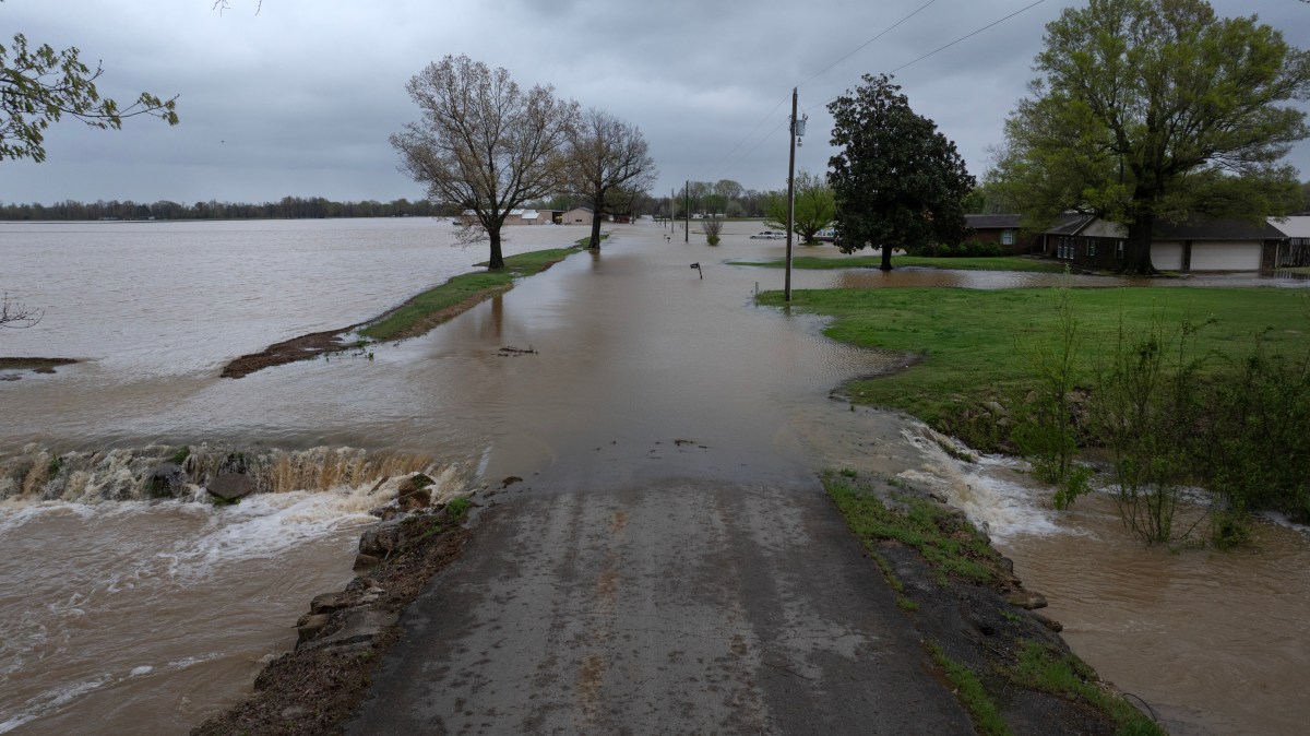
Flood watches stretched across at least a dozen states Tuesday as forecasters warned that repeated rounds of heavy rain could trigger flash flooding from the Southern Plains to the Mid-Atlantic, with some areas already saturated and vulnerable to rapid runoff.
National Weather Service (NWS) offices issued flood watch alerts covering broad swaths of Texas, southeastern Louisiana, southern Mississippi, much of Alabama, western Georgia, the Florida panhandle, northern Kentucky, southeastern Indiana, southern Ohio, northern West Virginia, southwestern Pennsylvania and western Maryland on Tuesday. In some cases, torrential rain prompted the more severe flash flood warnings in Texas, West Virginia, and Ohio.
At the core of the threat is a slow-moving weather pattern expected to produce “training” storms—in which repeated downpours track over the same areas—raising the risk of flooding in low-lying communities, rivers, and urban areas.
Weather Radar Live Tracker Maps
Animated weather footage from windy.com shows thunderstorms and rain affecting much of the Midwest, Southeast, and Southern U.S. as of 4 p.m. ET on Tuesday.
Rain Accumulation Forecasts
Over the next three days, much of the U.S. will see at least half an inch of rain, with some states seeing up to three inches, such as parts of Texas, Oklahoma, and Missouri.
Texas Flood Watch
In Central Texas and the Hill Country, including the Austin and San Antonio corridor, forecasters warned of “life-threatening flooding” potential beginning Tuesday afternoon into Wednesday morning. Rainfall totals of 1 to 3 inches, with isolated amounts up to 5 inches, could fall quickly, overwhelming creeks and low-water crossings.
In West Central Texas, storms moving through Tuesday could deliver similar totals on already saturated ground, prompting concerns about rapid runoff in rural areas and city streets alike.
Parts of Texas are also under a severe thunderstorm watch and a severe thunderstorm warning, with large, damaging hail and strong winds accompanying the heavy rain.
Mississippi Valley Flood Watch
Across the Lower Mississippi Valley, flood watches cover southeast Louisiana and southern Mississippi, where a stalled boundary is expected to trigger repeated rounds of storms on Wednesday. Officials warned of possible structural flooding, impassable roads and dangerous conditions in urban areas, particularly near New Orleans and coastal communities.
Gulf Coast Flood Watch
In the Deep South and Gulf Coast, watches remain in effect across Alabama, the Florida Panhandle, and west Georgia, where heavy rain from earlier systems has primed the ground. Some areas could see localized rainfall totals of 6 to 8 inches, increasing the risk of flash flooding through Tuesday evening.
Ohio Valley and Appalachian Flood Watch
A separate but connected system is expected to push northward, bringing a widespread heavy rain event to the Ohio Valley, Central Appalachians, and parts of the Mid-Atlantic.
Flood watches were issued for Southern and Central Ohio, Northern Kentucky, Southeast Indiana, and West Virginia, where a warm front lifting north will fuel rounds of thunderstorms through Wednesday night. Forecasters expect widespread rainfall of 1 inch or more, with localized totals of 2 to 3 inches.
In parts of Eastern Kentucky, including east-central regions, forecasters said recent rainfall has “primed” soils for flash flooding, meaning even moderate additional rain could quickly lead to rising waterways.
Further east, watches extend into Southwest Pennsylvania, Western Maryland, and parts of South Central Pennsylvania, including mountainous terrain where runoff can accumulate rapidly. Repeated rainfall over already swollen streams could push water levels over banks.
Flood Watch vs. Flash Flood Warning
A flood watch means conditions are favorable for flooding to develop, typically due to forecasts of heavy rainfall, saturated soils or slow-moving storms. It is an early alert that flooding is possible in the coming hours or days, giving residents time to monitor forecasts and prepare, especially in areas prone to rising rivers or creeks or to poor drainage.
A flash flood warning, by contrast, is issued when flooding is imminent or already happening. These warnings signal a more urgent and dangerous situation, often triggered by intense rainfall that can cause water levels to rise rapidly with little notice. Officials urge immediate action during a warning, including moving to higher ground and avoiding flooded roadways, as flash floods are among the deadliest weather hazards.
What Happens Next
Forecasters say the flood threat will evolve over the next 24 to 48 hours as multiple rounds of showers and thunderstorms develop along slow-moving fronts. Areas already under flood watches could see conditions deteriorate quickly, particularly where storms repeatedly move over the same locations, and rainfall accumulates faster than waterways can handle.
If heavier rain materializes, flood watches may be upgraded to flash flood warnings with little lead time. Officials urge residents in affected regions to stay alert for updates, monitor local forecasts and be ready to act quickly, especially overnight when rising water can be harder to detect.
Read the full article here
