


Two large storms are currently whipping up in the Atlantic Ocean—one hurricane and one tropical storm.
While neither storm is expected to make direct landfall in the U.S., they are likely to impact island nations in the Caribbean and Atlantic Ocean, as well as bringing heavy rain and flooding to some parts of the east coast.
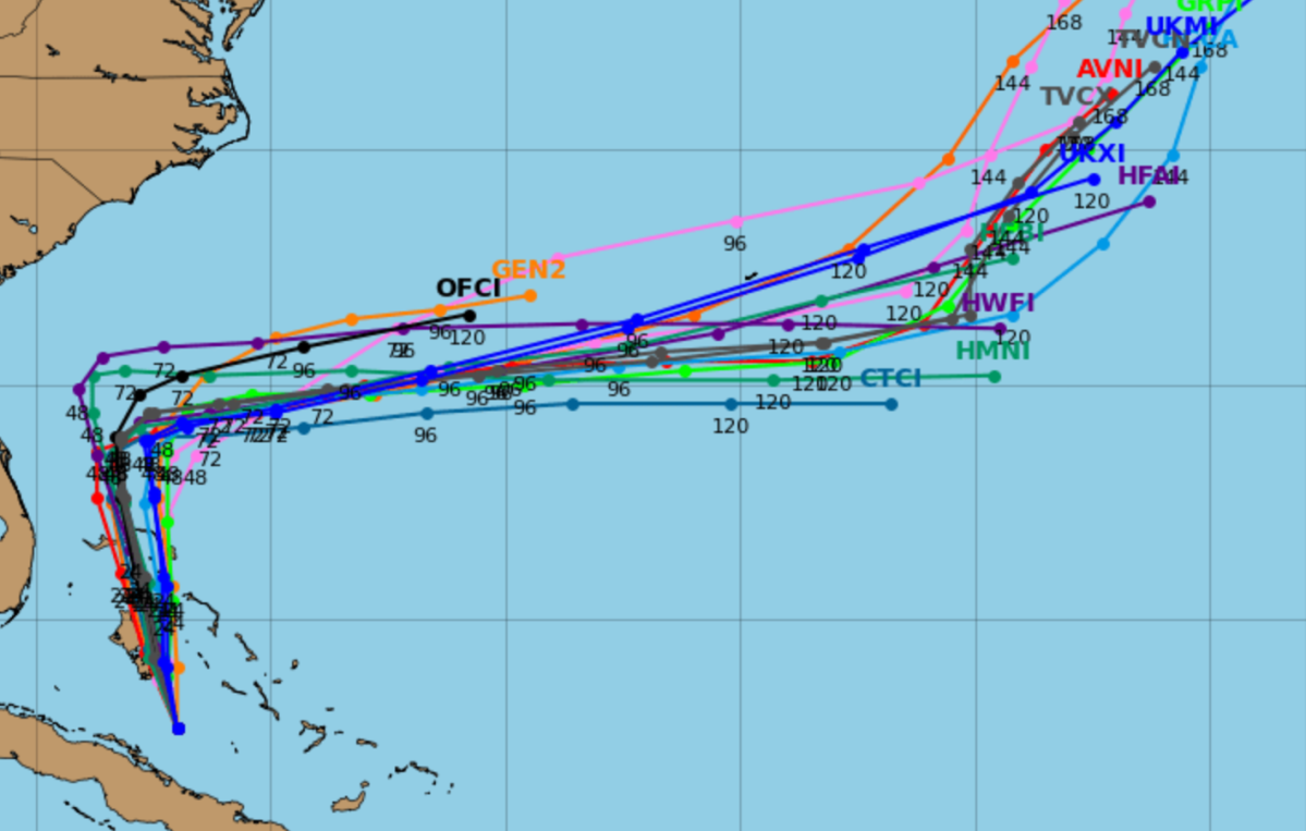
Tropical Depression 9
Models produced by the National Hurricane Center (NHC) show Tropical Depression 9 is expected to move northward past Florida starting at 8 p.m. ET on Sunday, traveling in the direction of Georgia, North Carolina and South Carolina as Monday progresses. Spaghetti models produced by Tropical Tidbits show the storm will then make a sharp right turn out into the Atlantic toward Bermuda, which is expected to happen at around 8 a.m. on Tuesday.
“The depression is expected to strengthen and bring tropical storm conditions to portions of the central and northwestern Bahamas through Sunday night,” a Saturday evening notice reads. “Tropical storm conditions are also possible along portions of the east coast of central Florida beginning Monday, where a Tropical Storm Watch is in effect.
The NHC warns of a “significant threat” along the east coast of Florida and continuing up into the Carolinas, “which could cause flash, urban, and river flooding.”
“The depression is expected to be at or near hurricane intensity when it is closest to the southeast U.S. coast early next week, where there is a risk of storm surge and wind impacts,” the NHC said. “Although it is too soon to specify the exact location and magnitude of impacts, residents should closely monitor the latest forecast updates and ensure that they have their hurricane plan in place.”
Hurricane Humberto

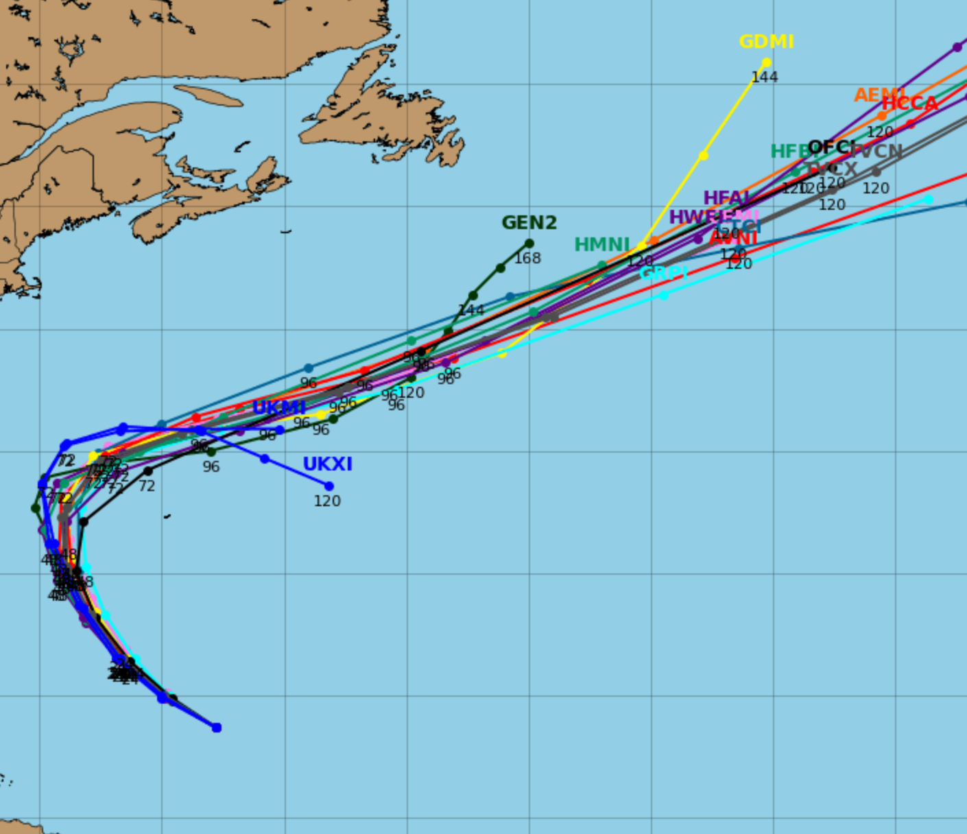
Category 5 Hurricane Humberto has formed north of the U.S. and British Virgin Islands in the Caribbean, with winds of up to 160 mph reported on Saturday evening.
Spaghetti models show a turn toward the north-northwest is likely on Tuesday evening, and it will lose intensity as it skims past Bermuda overnight before eventually dissipating further into the Atlantic as the week progress.
“Swells generated by Humberto will affect portions of the northern Leeward Islands, the Virgin Islands, Puerto Rico, and Bermuda beginning tonight and continuing through next week,” the NHC said in its Saturday evening update. “Swells from Humberto will also affect the U.S. East Coast beginning Monday. These swells are likely to cause life-threatening surf and rip current conditions.”
What People Are Saying
South Carolina Governor Henry McMaster, regarding Tropical Depression 9: “As this storm approaches our coast, I am issuing a State of Emergency to ensure Team South Carolina is able to access and deploy the resources and personnel needed to prepare for and respond to this storm.
“While the storm’s arrival, speed, and intensity remain hard to predict, we do know that it will bring significant wind, heavy rainfall, and flooding across the ENTIRE state of South Carolina. We have seen this before. Now is the time to start paying attention to forecasts, updates, and alerts from official sources and begin making preparations.”
Atlantic Hurricane Season So Far
So far in the 2025 Atlantic hurricane season, nine tropical cyclones have formed, eight of which became named storms. Three of those intensified into hurricanes, and all three reached major hurricane status (Category 3 or higher). Hurricane Erin became a Category 5 storm, while Hurricane Gabrielle reached Category 4 strength.
Read the full article here


