


Newsweek has created a map showing which lakes are declining in water levels fastest.
Lake Mead, in Nevada and Arizona, Lake Powell in Utah and Arizona, the Great Salt Lake in Utah, Salton Sea in California and Walker Lake in Nevada, are the five fastest-drying lakes in America, according to WorldAtlas analysis.
Why It Matters
Water levels in major reservoirs across the western United States influence drinking water supplies, hydroelectric power generation and agricultural irrigation for millions of people.
A sustained drop in lake elevations can also expose shoreline infrastructure, affect recreation industries and reduce available water storage during periods of drought or increased demand.
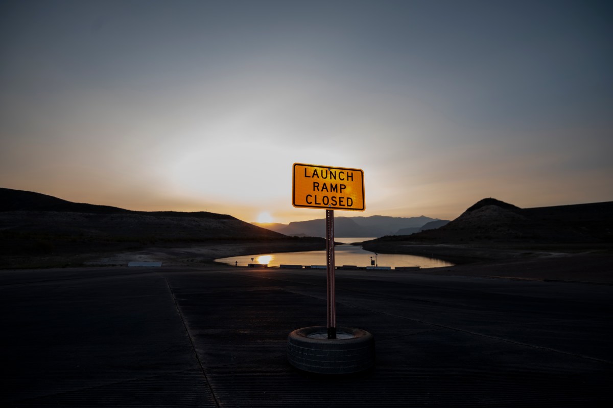
Lake Mead
Lake Mead, which straddles the Nevada–Arizona border, is the largest reservoir in the United States and a key storage point for water from the Colorado River. When full, the reservoir spans roughly 250 square miles and holds about 9.3 trillion gallons of water.
The water level is now less than 10 feet from reaching critical water-shortage levels, according to WorldAtlas.
Water levels at the reservoir have been falling for decades, driven by prolonged drought in the Colorado River basin and increasing demand from rapidly growing cities. The lake supplies water to millions of people, including residents of Las Vegas.
Lake Powell
Lake Powell, which stretches across the Utah–Arizona border, is the second-largest man-made reservoir in North America and a key part of the Colorado River storage system.
At full capacity, the reservoir covers about 161,000 acres and can hold roughly 27 million acre-feet of water. The lake is currently 25% full, according to WorldAtlas.
Great Salt Lake
The Great Salt Lake in Utah is the largest natural lake west of the Mississippi River and the largest saltwater lake in the Western Hemisphere.
Water levels have declined steadily since the mid-1980s, with the lake losing roughly four inches of elevation each year. The lake has now lost about 73 percent of its water and roughly 60 percent of its surface area, with some shorelines retreating by as much as 20 miles, according to WorldAtlas.
Salton Sea
The Salton Sea is California’s largest lake by surface area and sits in the state’s southeastern desert region.
The lake covers about 376 square miles and can hold roughly 7.5 million acre-feet of water, but projections indicate the shoreline could continue retreating in the coming decades as inflows remain lower than the roughly 1.3 million acre-feet of water lost to evaporation each year, according to WorldAtlas.
Walker Lake
Walker Lake in western Nevada is a terminal lake, meaning water leaves the basin only through evaporation.
The lake covers about 30,000 acres and is fed primarily by the Walker River and seasonal snowmelt from the Sierra Nevada. However, much of that water is diverted upstream for agriculture before it reaches the lake.
Water diversions that began about a century ago for irrigating crops and pasture have contributed to a dramatic decline in the lake’s volume, which has fallen by about 90 percent.
In a polarized era, the center is dismissed as bland. At Newsweek, ours is different: The Courageous Center—it’s not “both sides,” it’s sharp, challenging and alive with ideas. We follow facts, not factions. If that sounds like the kind of journalism you want to see thrive, we need you.
When you become a Newsweek Member, you support a mission to keep the center strong and vibrant. Members enjoy: Ad-free browsing, exclusive content and editor conversations. Help keep the center courageous. Join today.
Read the full article here


