


Post-Tropical Storm Arthur is now unleashing potentially catastrophic and life-threatening flooding throughout the South, as days of heavy rain will slam communities in Louisiana, Mississippi and Alabama.
The remnants of Tropical Storm Arthur persist, as millions of Americans are at risk of flash flooding from Eastern Texas to Georgia.
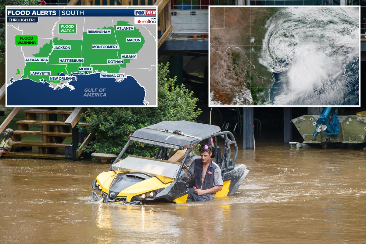
A Level 4 out of 4 flash flood threat has been issued for Thursday and a Level 3 out of 4 risk for Friday in the Southeast U.S., where widespread rain and catastrophic flooding are possible.
Locations with a high flood risk include Baton Rouge, Louisiana; Jackson, Mississippi; Montgomery, Alabama; and Atlanta.
“Pacific and Gulf moisture combining into a persistent plume across the South will increase the flooding risk across Louisiana, Mississippi and Alabama as the heaviest moisture remains on the eastern side of the storm as it moves northward in the coming day,” said the FOX Forecast Center.
As a result, flood watches are in effect across most of Louisiana, Mississippi, Alabama, and Georgia.
The flooding has already claimed the life of a 15-year-old in Texas, who drowned in a flooded pond.
A massive multi-unit search was coordinated, with boats and specialized diving teams deployed.
Following an extensive search and the use of sonar technology, the teenager was located submerged in the water and pronounced deceased at the scene, according to the Montgomery County Sheriff’s Office.
Overall, widespread rainfall could total 5 to 8 inches across Southern Texas to Alabama, with 8 to 12 inches possible in portions of Louisiana, which could result in deadly flash flooding.
Outside of the flash flood risk, there is a lingering Level 2 out of 5 severe storm threat across coastal Mississippi and into Southern Alabama, where tornadoes are possible.
As the remnants of Arthur move toward the Carolinas, rounds of persistent rain will kick off on Thursday and last well into Friday, but there is uncertainty about when exactly the heaviest rain will fall.
As this mid-level spin moves offshore, it will hover over the warm waters of the Gulf Stream.
At this point on Friday, a new area of low pressure could form, bringing gusty winds and heavy rain to coastal regions along the East Coast.
This is unlikely to be a tropical threat, but it is worth monitoring amid potential development in the coming days.
Read the full article here


