


Millions of Americans from Texas to New York are under frost advisories and freeze warnings Friday afternoon as a massive cold front sweeps across the United States, bringing a sharp and unseasonable drop in temperatures at the start of May.
The National Weather Service (NWS) issued a wide swath of cold-weather alerts across the Southern Plains, Midwest, Northeast and Mid-Atlantic as the front pushed east, with nighttime lows expected to plunge below freezing in some areas. Forecasters warned the sudden chill could damage early-season crops and sensitive vegetation, posing a particular risk as much of the country has already entered the growing season.
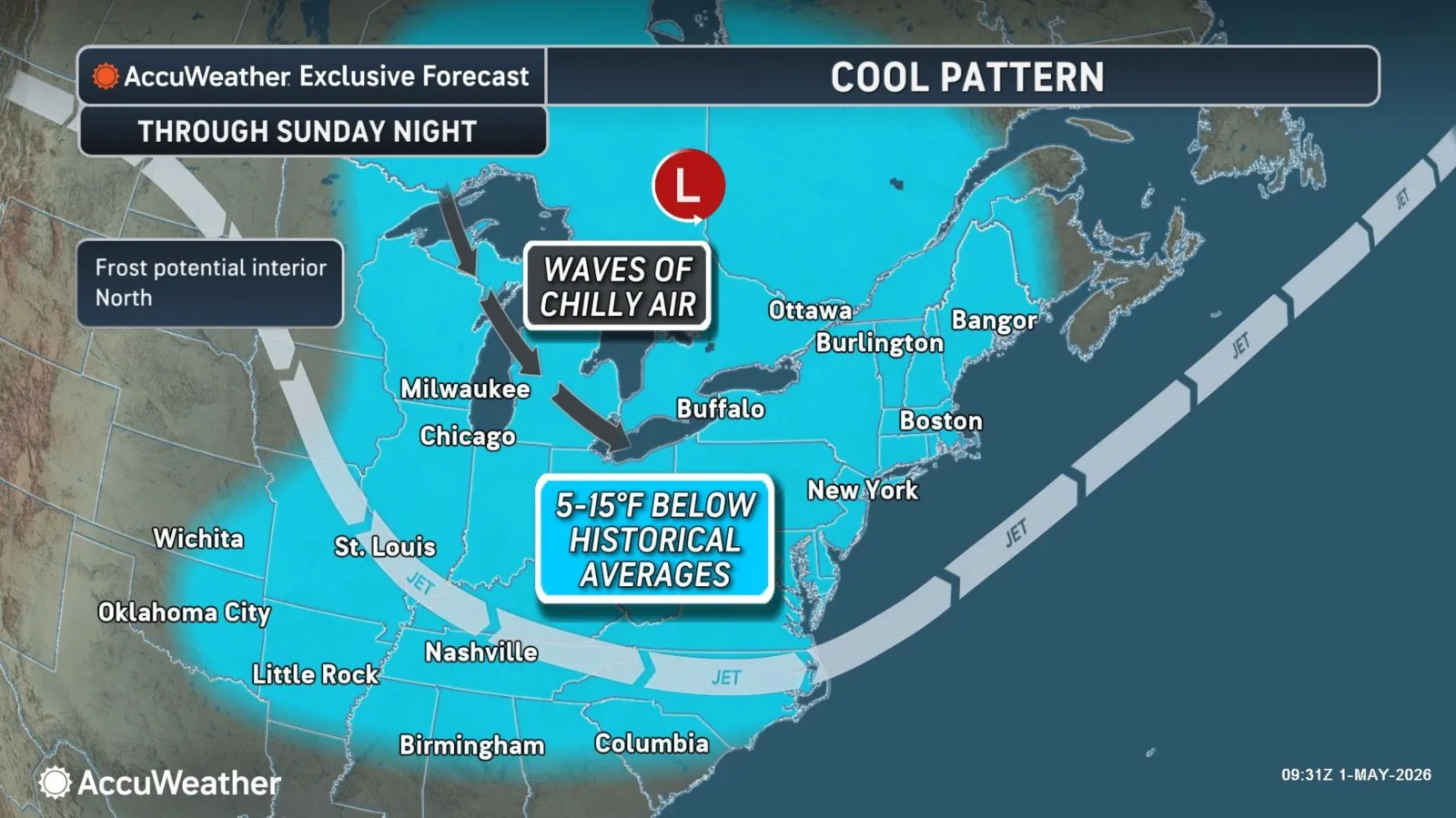
The surge of cold temperatures is the result of a polar vortex that hit in March and April, AccuWeather lead long-range expert Paul Pastelok told Newsweek. It “created an atmospheric traffic jam” that allowed waves of cold air to move south from Canada into the Midwest and Northeast, Pastelok said.
“Below-average departures during the first 10 days of May will be significant, especially in the Ohio Valley, Great Lakes and interior Northeast,” Pastelok said.
On Friday afternoon, frost advisories and or freeze warnings were in place for the following states: Texas, Oklahoma, Colorado, Kansas, Nebraska, South Dakota, Iowa, Missouri, Minnesota, Wisconsin, Illinois, Michigan, Indiana, Kentucky, Ohio, West Virginia, Pennsylvania and New York.
The coldest weather will hit western and southern Wisconsin, where temperatures as low as 23 degrees were expected overnight Friday, the NWS office in La Crosse said in a freeze warning.
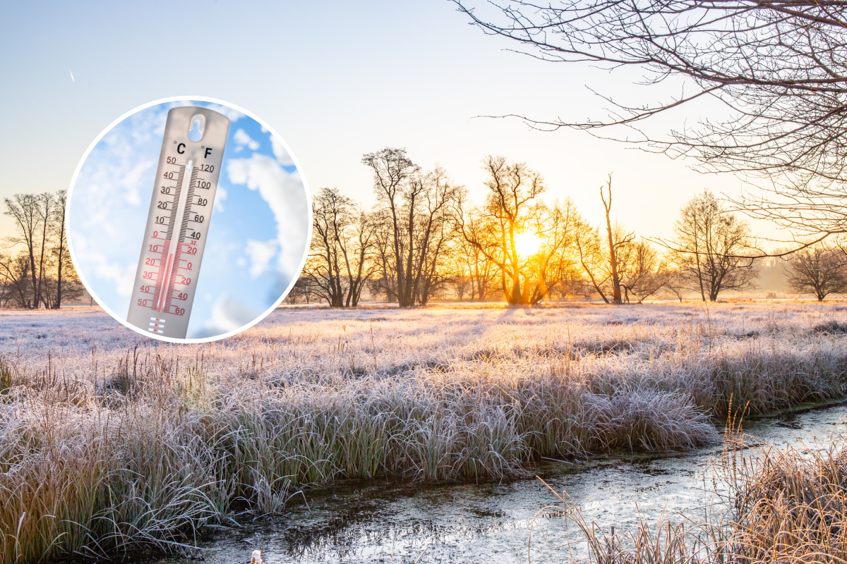
Some areas were not expecting temperatures to fall below 32 degrees, but frost was still a risk. Frost forms based on the temperature of surfaces, not the official air temperature in a forecast. Air temperature is typically measured about 5 to 6 feet above the ground, but on clear, calm nights, surfaces like grass, car roofs, or rooftops can cool much faster than the surrounding air through radiational cooling.
As these surfaces lose heat to the open sky, their temperature can fall below 32 degrees even while the air a few feet above them stays in the mid-30s or higher. When that surface temperature drops below freezing, and there’s enough moisture in the air, water vapor deposits directly as ice crystals, forming frost.
In most cases, the warnings were in place for Friday night. However, a freeze watch was in place for Kentucky, Virginia, West Virginia, and Pennsylvania, warning of freezing temperatures on Saturday night as well.

“After this weekend, most nights should not bring frost or freeze conditions in the Midwest and Northeast, but a couple of nights could still see them, especially in the Midwest away from the Great Lakes,” AccuWeather senior meteorologist Brett Anderson told Newsweek. “Clouds, breezes and showers will greatly limit the risk in the Northeast.”
Despite the frigid weather, AccuWeather is not anticipating that this May will be the coldest on record for the affected areas, AccuWeather senior long-range meteorologist Chad Merrill told Newsweek.
Read the full article here


