


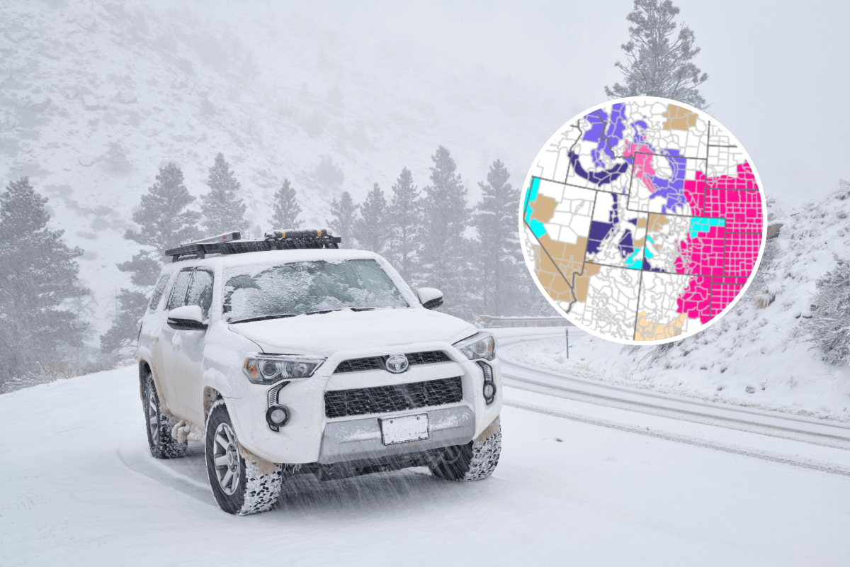
A late‑season winter storm is set to bring heavy mountain snow, gusty winds and hazardous travel conditions across parts of the western and northern United States, with some areas bracing for up to 2 feet of snow.
Warnings and advisories stretch across Oregon, Washington, Montana, Wyoming, Idaho and Alaska, according to the National Weather Service (NWS).
Forecasters say rapidly deteriorating road conditions could make travel dangerous through Thursday night and into Friday in some regions.
In one advisory, the NWS urged drivers to “consider postponing travel until weather conditions improve” as snow and wind intensify across mountain passes.
Montana and Wyoming High Country
The most significant snowfall is expected across parts of southern Montana and northern Wyoming, where multiple winter storm warnings remain in effect.
The NWS in Billings issued a warning at 11:08 p.m. Mountain Daylight Time Wednesday for the Absaroka-Beartooth Mountains and Crazy Mountains, which remains in effect until 6 a.m. MDT Friday.
Forecasters expect 1 to 2 feet of snow, with the highest totals above 9,000 feet.
Winds could gust as high as 55 mph, producing widespread blowing snow and sharply reduced visibility.
Impacts are expected to be significant for backcountry recreation and travel, particularly in exposed areas where whiteout conditions may develop.
Wind River and Teton Ranges
In Wyoming, winter storm warnings are posted for the Wind River Mountains, Teton and Gros Ventre Mountains, and Yellowstone National Park.
The NWS in Riverton issued the warnings at 11:56 a.m. MDT Wednesday. Conditions are expected to deteriorate beginning at 6 p.m. Wednesday, with warnings lasting until 6 a.m. Friday in Yellowstone and 6 p.m. Friday across the Wind River Range.
Snow totals of 9 to 18 inches are forecast, with isolated higher amounts possible at upper elevations. Wind gusts between 45 and 60 mph could significantly limit visibility, especially across South Pass, Teton Pass and Togwotee Pass.
Oregon and Washington Cascades
Heavy snow continues across the Oregon and Washington Cascades, where a winter storm warning issued by the NWS in Portland at 10:48 p.m. Pacific Daylight Time Wednesday remains in effect until 5 a.m. PDT Thursday for elevations above 2,500 feet.
Additional snow accumulations of up to 2 to 4 inches are expected overnight, adding to earlier totals that have already created hazardous driving conditions.
Impacts are expected along major mountain routes, including Santiam Pass, Willamette Pass, McKenzie Pass and Government Camp, where slick roads and poor visibility may persist.
In its advisory, the NWS cautioned motorists to “consider postponing travel until weather conditions improve,” noting that conditions may deteriorate rapidly overnight.
East Slopes of the Oregon Cascades
Another winter storm warning remains in effect for the East Slopes of the Oregon Cascades, issued by the NWS in Pendleton at 10:17 p.m. PDT Wednesday.
The warning lasts until 5 a.m. PDT Thursday for elevations above 4,000 feet.
Forecasters expect 3 to 7 inches of additional snow, with locally higher totals near the Cascade crest. Winds could gust up to 40 mph, contributing to slick roadways and blowing snow.
According to officials, travel is highly discouraged because of the potential for downed trees, power lines and rapidly changing conditions.
“Persons should consider delaying all travel,” the NWS said. “If travel is absolutely necessary, drive with extreme caution. Consider taking a winter storm kit along with you, including such items as tire chains, booster cables, flashlight, shovel, blankets and extra clothing. Also take water, a first aid kit, and anything else that would help you survive in case you become stranded.”
Other Mountain Regions
Beyond the warning areas, winter weather advisories blanket large portions of Montana, Idaho, Wyoming and Alaska, generally lasting through Thursday morning or Friday morning, depending on location.
Snow totals range from 1 to 6 inches in lower elevations to 6 to 13 inches in mountainous terrain, with strongest impacts expected near mountain passes such as Powder River Pass, Lolo Pass, Lookout Pass and Bozeman Pass.
In Alaska, an advisory issued by the NWS in Fairbanks at 1:51 p.m. Alaska Daylight Time Wednesday runs from 7 a.m. AKDT Thursday to 4 p.m. Saturday, with 6 to 12 inches expected along the eastern Alaska Range south of Trims Camp and locally higher totals in the surrounding high terrain.
Freeze Warnings Expand as Temperatures Plunge
Alongside heavy snow, dangerously cold temperatures are settling in across parts of the West, prompting a wave of freeze warnings and freeze watches from multiple NWS offices.
The NWS in Seattle issued a freeze warning for portions of western Washington, including the Olympia and southern Puget Sound area, in effect until 9 a.m. PDT Thursday, with overnight lows expected to fall to about 28 degrees.
In eastern Oregon and central Washington, the NWS in Pendleton warned of widespread subfreezing temperatures across the Kittitas and Yakima valleys, with freeze warnings running through Thursday morning, before conditions deteriorate further with a second freeze warning from late Thursday night into Friday morning, where lows could drop to 24 degrees.
Additional freeze warnings were issued by the NWS offices in Portland, Spokane, Boise, Salt Lake City, Grand Junction, Eureka and Medford, covering parts of Oregon, Washington, Idaho, Utah and northern California. Many of these alerts remain in effect through Thursday morning, with some extending into Friday and Saturday.
Forecasters warned that freezing temperatures could kill crops, damage sensitive vegetation and affect unprotected outdoor plumbing, urging residents to take precautions as cold air settles behind the storm system.
Read the full article here


