


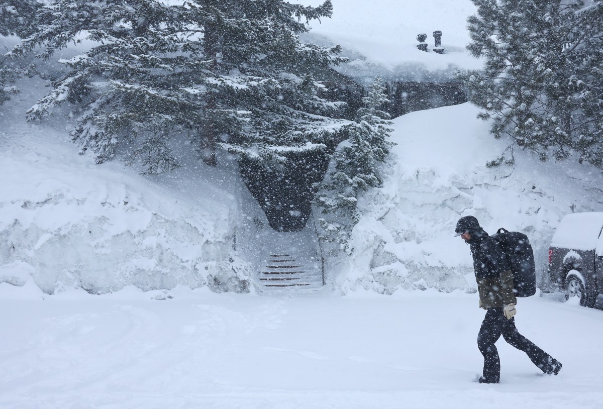
Up to 18 inches of heavy snow and strong winds reaching 90 mph are forecast to hit seven states from Wednesday, as the National Weather Service (NWS) warns that travel is likely to be “impossible” in some places. Subfreezing temperatures are also expected to blast parts of Utah, which could damage crops and outdoor plumbing.
States Affected by Heavy Snow and Strong Winds
The NWS has issued winter storm warnings and winter weather advisories to Montana, Wyoming, California, Nevada, Oregon, Washington and Idaho, which are in place from Wednesday to Thursday in most cases—or to Friday in some.
Montana and Wyoming
The Gallatin, Madison and Centennial Mountains are forecast to receive between 5 and 12 inches of snow and 40 mph winds from Wednesday afternoon until Thursday afternoon. The NWS has warned that “heavy, wet snow” could make travel difficult, cause power outages and bring down tree branches.
The eastern side of the Glacier National Park, along with the adjacent foothills and plains, could see up to 6 inches of snow and 45 mph winds—especially over Marias Pass—with more expected to fall across the highest areas from Wednesday afternoon until late Thursday afternoon. Blowing snow could reduce visibility, and tire chains might be needed as snow-covered roads could make driving conditions difficult, according to the NWS.
Similar conditions—up to 6 inches of snow and 50 mph winds—are likely across the Bear Paw Mountains and southern parts of Blaine County overnight Wednesday, lasting until Thursday afternoon.
The Snowy and Judith Mountains, alongside areas below 4,500 feet across Fergus County, could see up to 12 inches of snow, particularly along the highest peaks, and winds gusting around 55 mph from around midnight on Wednesday, lasting until late Thursday afternoon.
Up to 8 inches of snow and 40 mph winds are forecast for parts of central, north-central and southwest Montana from Wednesday afternoon through around noon on Friday.
Big Belt, Bridger and Castle Mountains could receive between 5 and 9 inches of snow and winds reaching 50 mph from Wednesday afternoon, lasting until Thursday afternoon.
The Absaroka and Beartooth Mountains in southern Montana and northern Wyoming are expected to see up to 18 inches of snow and strong winds, especially in the Stillwater River Valley, reaching 60 mph from Wednesday afternoon through Thursday and lasting until Friday morning.
Between 5 and 10 inches of snow and 50 mph winds could strike the Salt River and Wyoming Ranges, and up to 12 inches of snow (up to 18 is expected across the highest elevations) and winds reaching 45 mph are forecast to hit the Teton and Gros Ventre Mountains and parts of the Yellowstone National Park from around noon on Wednesday, lasting until Thursday evening.
Montana and Idaho
Salmon; Bannock Pass; Shoup; Williams Creek Summit; Highway 28, from Tendoy to Lone Pine; Lemhi Pass; Highway 93, from Lost Trail Pass to Gibbonsville; the Highway 93 stretch from Sula to Lost Trail Pass; and Lolo Pass could see up to 5 inches of snow below 4,000 feet, up to 10 inches at pass level, and up to 12 inches across the highest peaks from Wednesday afternoon, lasting until around noon on Friday. The NWS has warned those who plan to travel to expect “hazardous conditions,” road closures and infrastructure disruptions—especially over the highest passes.
Parts of Highway 200, from Bonner to Greenough; the Interstate 90, from east Missoula to Bearmouth; Highway 83, from Seeley Lake to Condon; Georgetown Lake; Butte; Highway 12, from Garrison to Elliston; and the MacDonald and Homestake Passes are expected to get similar conditions—up to 5 inches of snow in the valleys, up to 10 inches at pass level and up to 12 inches across the highest elevations—with winds reaching 35 mph from Wednesday afternoon through Thursday and lasting until around midday on Friday.
In central Idaho, the Big Lost Highlands, Copper Basin, Frank Church Wilderness, Lost River Range, Sawtooth, Stanley Basin and the Sun Valley Region could see up to 9 inches of snow and winds reaching 40 mph through Wednesday into Thursday morning.
California and Nevada
The NWS has warned that 45 mph winds and anywhere from 3 inches to 1 foot of snow are expected, especially across the highest peaks, along the Kaiser to Rodgers Ridge, the upper San Joaquin River, and the Kings Canyon, Sequoia, and Yosemite National Parks by late Wednesday afternoon. The “hazardous” conditions are expected to affect the Wednesday morning and evening commutes.
Northern parts of the Sierra Nevada and the southern Cascades, above 5000 feet—which includes Highway 50, Interstate 80, and the Lassen Volcanic National Park—could see between 6 and 12 inches of snow, with up to 18 inches likely across the highest peaks, along with 50 mph winds lasting until Wednesday afternoon.
Through Wednesday, parts of the greater Lake Tahoe area could see up to 10 inches of snow and 90 mph winds across the highest ridges, with about 3 inches expected at the lake level. The NWS has warned that “isolated lightning” could strike areas along the Sierra Crest on Wednesday afternoon, and travel across the Sierra passes could be hazardous and could affect local commutes.
Mono County could receive up to 10 inches of snow in areas above 7,000 feet, with winds reaching 60 mph in exposed areas, especially along U.S. 395, and even reaching up to 90 mph along the highest ridge tops until Wednesday afternoon.
Oregon
Areas above 4,500 feet across the northern and southern parts of the Blue Mountains in northeastern Oregon are expected to get between 4 and 12 inches of snow and 50 mph winds through Wednesday.
Washington
Up to 12 inches of snow and 50 mph winds are forecast for areas above 4,500 feet across the northwest parts of the Blue Mountains in southeastern Washington—with more expected across the highest peaks, above 5,000 feet—until Wednesday evening.
Areas in Utah Affected by Subfreezing Temperatures
Communities in Utah have been told to brace themselves for subfreezing temperatures through Wednesday night into Thursday morning.
Castle Country could see temperatures as low as 30 degrees Fahrenheit, western parts of the Uinta Basin could drop to 28 degrees Fahrenheit, and both the eastern and western parts of Millard and Juab Counties, the Sanpete and Sevier Valleys, and parts of southwest Utah could see temperatures plummet to as low as 25 degrees Fahrenheit.
Read the full article here


