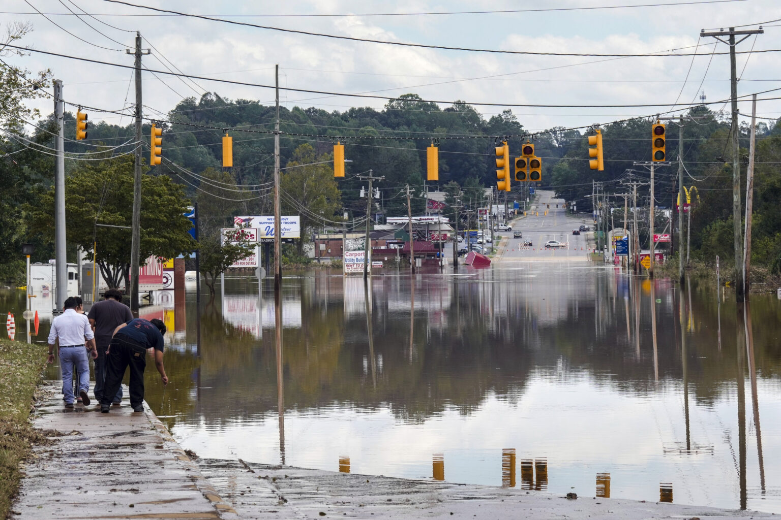
The recent devastation caused by Hurricane Helene, which unleashed unprecedented flooding across several Appalachian states, has served as a reminder of the region’s vulnerability to extreme weather in the era of climate change.
Hendersonville, North Carolina, along with other mountain communities, faced immense damage as floodwaters tore through roads, wiped out communications and inundated homes with mud and debris. Deadly floods from Helene claimed the lives of over 160 people across six Southeastern states.
The disaster came as a shock to residents and experts alike as Jeremy Porter, head of climate implication research at First Street, a company that analyzes climate risk noted.
“We almost always associate flood risk with hurricanes and coastal storm surge in Florida, Louisiana and Texas,” Porter told The Associated Press (AP). “We don’t think of western North Carolina and the Appalachian mountains as an area that has significant flood risk.”
However, despite its distance from the coast, the region’s steep valleys make it especially prone to flooding when storms like Helene unleash torrential rainfall.
This is also not the first time hurricanes moving inland with heavy rainstorms have created disaster. In 2004, four people were killed in western North Carolina from a debris flow caused by as much of a foot (30.5 centimeters) of rain that fell from Hurricane Ivan.
While the exact role of climate change in this specific event has not been determined, scientists have long warned that a warming planet makes hurricanes wetter and likely increases rainfall totals in some areas.
The AP reported that Jim Smith, a hydrologist at Princeton University, said that a warmer atmosphere can hold more water, fueling intense rainstorms. He added that Appalachia’s mountainous terrain further complicates how climate change interacts with local weather patterns.
Adding to the problem, Porter noted that Federal Emergency Management Agency (FEMA)’s flood maps—which help determine which areas are most at risk where certain homeowners are required to purchase flood insurance —have been criticized for underestimating the threat in regions like Appalachia. He said the maps fail to account for the increasing frequency and severity of heavy rainfall events.
“It’s happening more and more often that we’re seeing these heavy precipitation events occur, exactly the type of events that this region is susceptible to,” Porter told the AP, adding that flood zones on FEMA maps aren’t capturing these changing conditions.
Such inaccurate information could leave homeowners and policymakers unprepared for the kind of disasters now becoming more common.
While FEMA recently updated its flood insurance pricing to factor in more types of flooding, the agency warned that flood maps are not meant to predict what areas will flood. Instead, they help define the riskiest areas for planning and insurance needs, FEMA said.
“Flooding doesn’t follow lines on a map. If it rains, it can flood,” FEMA spokesperson Daniel Llargues said to the AP.
While Hurricane Helene’s destruction may not come as a total surprise to climatologists, the scale of the loss and damage has left communities reeling and could spark discussions about how climate change is reshaping even the most unlikely regions.
This article includes reporting from The Associated Press.
Read the full article here

