


Monsoonal thunderstorms accompanied by heavy rainfall and possible flash floods will sweep across the U.S. on Wednesday, posing a risk for five states.
Why It Matters
The North American monsoon typically occurs during the summer months, usually between June and September. It can bring excessive rainfall to areas across the U.S. Southwest that typically don’t see much rain, such as desert areas in New Mexico.
The monsoon occurs as high pressure forms in the summer and winds bring moisture from the Pacific Ocean and Gulf of California across the nation. The phenomenon is heightening the risk of flooding thunderstorms across five states in the U.S. on Wednesday, prompting the advisories.
What To Know
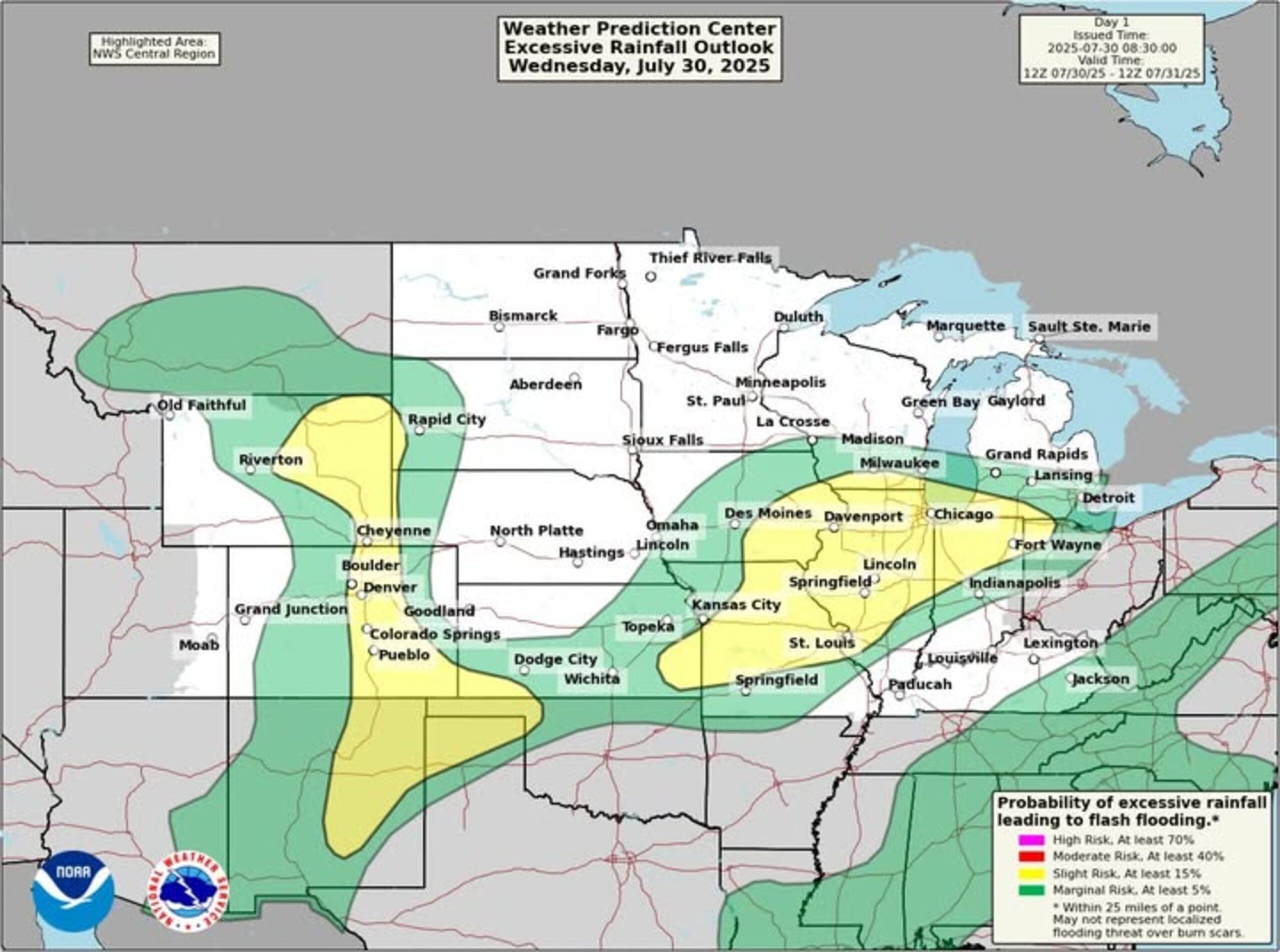
On Wednesday morning, the National Weather Service (NWS) shared a map on Facebook showing where monsoonal moisture could cause weather hazards.
“Monsoonal thunderstorms producing heavy rainfall and the potential for flash flooding is expected across New Mexico into the Rockies today,” the post said. “Recently burned areas will be most susceptible to flash flooding.”
The post also mentioned that strong thunderstorms, though not monsoonal in nature, will “bring a heavy rainfall and flooding threat to the Mid-Mississippi Valley today, and the Mid-Atlantic and Northeast on Thursday.”
According to a map shared with the post, states most at risk for monsoonal thunderstorms include New Mexico, Texas, Oklahoma, Colorado and Wyoming.
In some areas, flood watches have already been issued.
“Showers and thunderstorms will develop across the higher terrain early Wednesday afternoon slowly moving north and northeast into the evening hours,” the NWS office in Albuquerque, New Mexico, said in a flood watch. “Thunderstorms will be capable of producing rainfall rates of up to 3 inches an hour which could produce flash flooding and debris flows on the Ruidoso area and Hermits Peak and Calf Canyon burn scars.”
The advisory comes as parts of New Mexico, including the Ruidoso area, have already faced catastrophic flash floods this summer.
What People Are Saying
NWS meteorologist David Craft, who works at the Albuquerque office, told Newsweek: “We are especially concerned about our burn scars this afternoon and early evening….Some storms are capable of producing torrential rainfall at rates near 2 inches per hour, potentially over 2 inches per hour.”
NWS office in Pueblo, Colorado, in a flood watch: “Excessive runoff may result in flooding of rivers, creeks, streams, and other low-lying and flood-prone locations. Flooding may occur in poor drainage and urban areas.”
What Happens Next
Most flood watches related to the current round of storms will expire by Wednesday evening, although the monsoon will likely prompt similar alerts as the season progresses.
Read the full article here


