


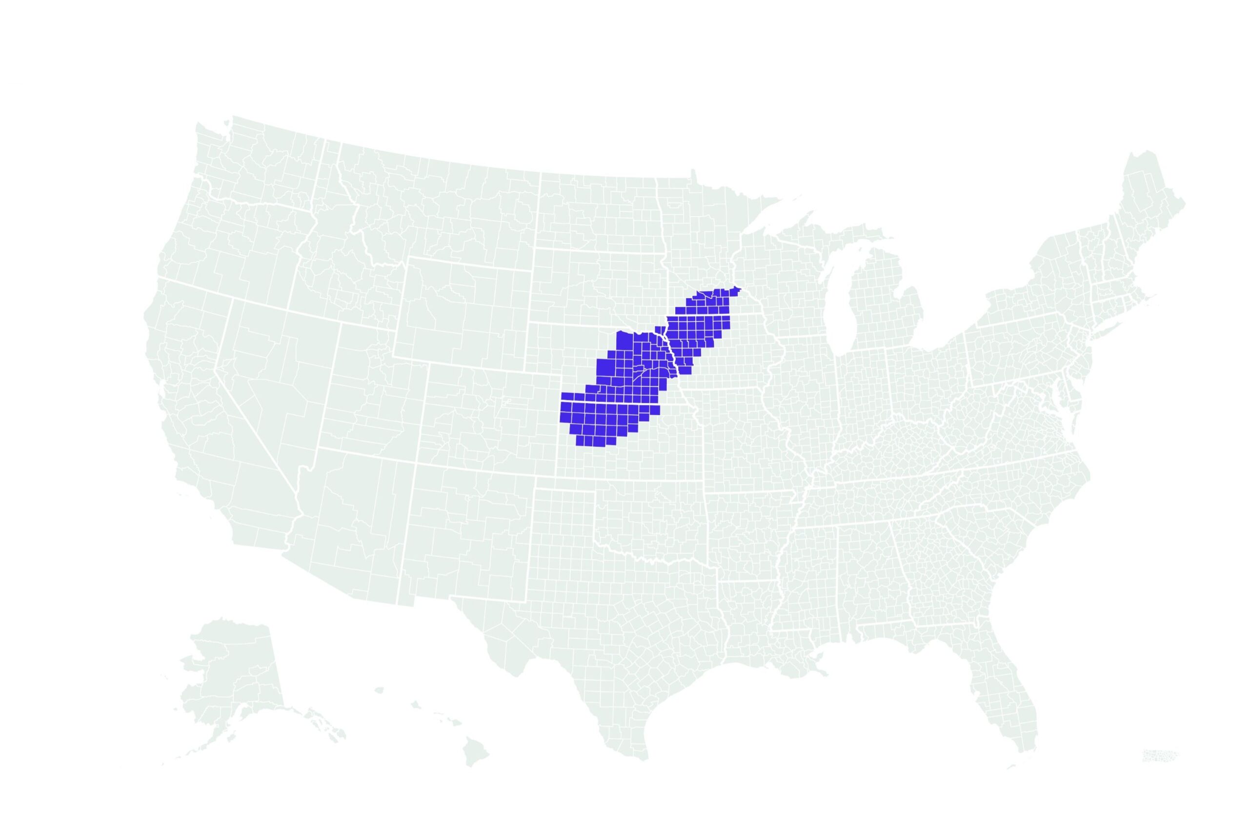
The National Weather Service (NWS) has issued blizzard warnings for portions Iowa, Minnesota, Kansas and Nebraska, effective through Wednesday, as a strong storm moves across the country.
Why It Matters
Blizzard conditions are anticipated, with several inches of snow forecast.
Meteorologists warn that blowing snow could reduce visibility, and travel conditions would be very dangerous.
What To Know
Affected areas included southern Minnesota, northwest Iowa, northwest Kansas and a central and eastern portion of Nebraska.
In Iowa, the NWS said up to 10 inches of snow was expected, with winds gusting as high as 65 mph. In Kansas, gusts of up to 70 mph were possible.
In other areas affected by the warnings, visibility could drop below a quarter-mile, it said, warning that travel should be restricted to emergency situations.
The hazardous conditions could impact the Wednesday morning commute, with treacherous road conditions expected. Very strong winds, combined with the snow, could cause extensive tree damage and additional stress to power lines, the NWS said.
AccuWeather meteorologist Tom Kines told Newsweek that after bringing snow and blizzard conditions to the Plains and Upper Midwest, this storm will track northeast into Canada by Wednesday night, significantly reducing its impact on the United States and ending the blizzard threat.
However, the colder air trailing the storm will continue moving eastward and could create issues for the Northeast later in the week, and a new storm is expected to develop off the Mid-Atlantic coast on Thursday and move northeast along the coastline, Kines said.
What People Are Saying
AccuWeather meteorologist Tom Kines told Newsweek: “Blizzard conditions are accompanied by wind or wind gusts over 35 mph. The areas that are currently under a blizzard warning will have gusts between 40 and 60 mph and it’s not out of the question there are higher gusts.
“Obviously, winds of this magnitude along with accumulating snow will create visibilities near zero and extremely hazardous and dangerous travel. Road closures are a possibility. The wind will make it feel like temperatures are in the single digits. Traveling is this storm is not recommended.”
The National Weather Service, on X, formerly Twitter: “A strong spring storm will bring high winds and extremely critical fire weather to parts of the southern Plains Tuesday, then heavy snow and possible blizzard conditions from the central Plains to the Upper Midwest on Wednesday.”
What Happens Next
The latest blizzard warnings were in effect until Wednesday.
Forecasts are sometimes subject to change, and the NWS issues regular updates on its website.
Read the full article here


