


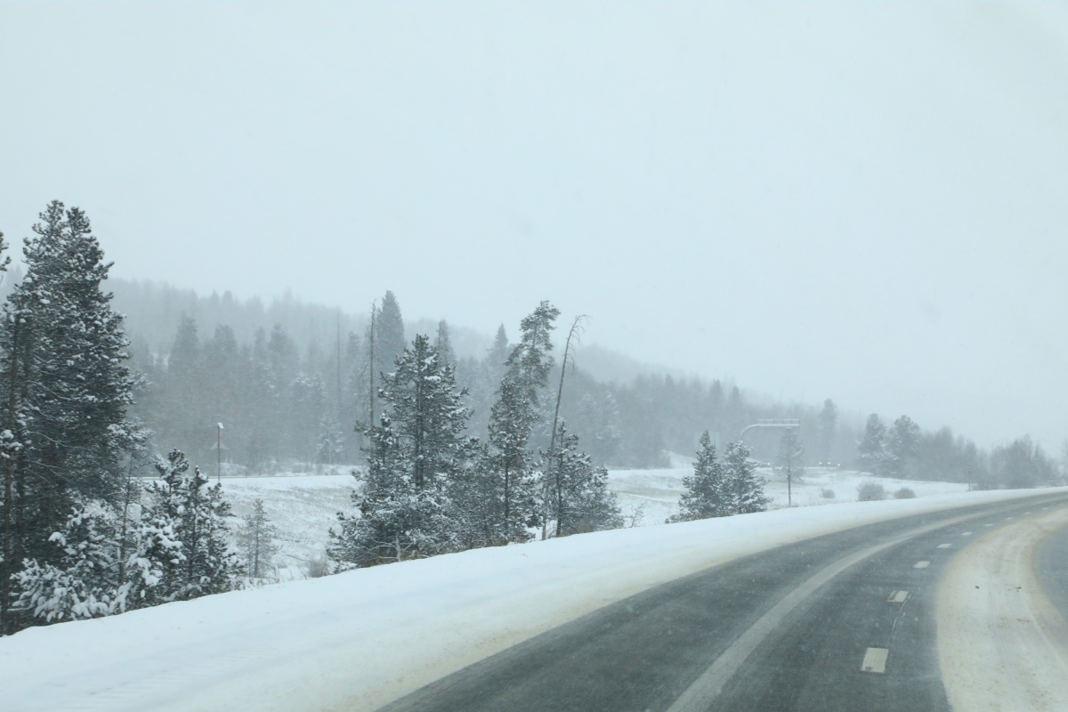
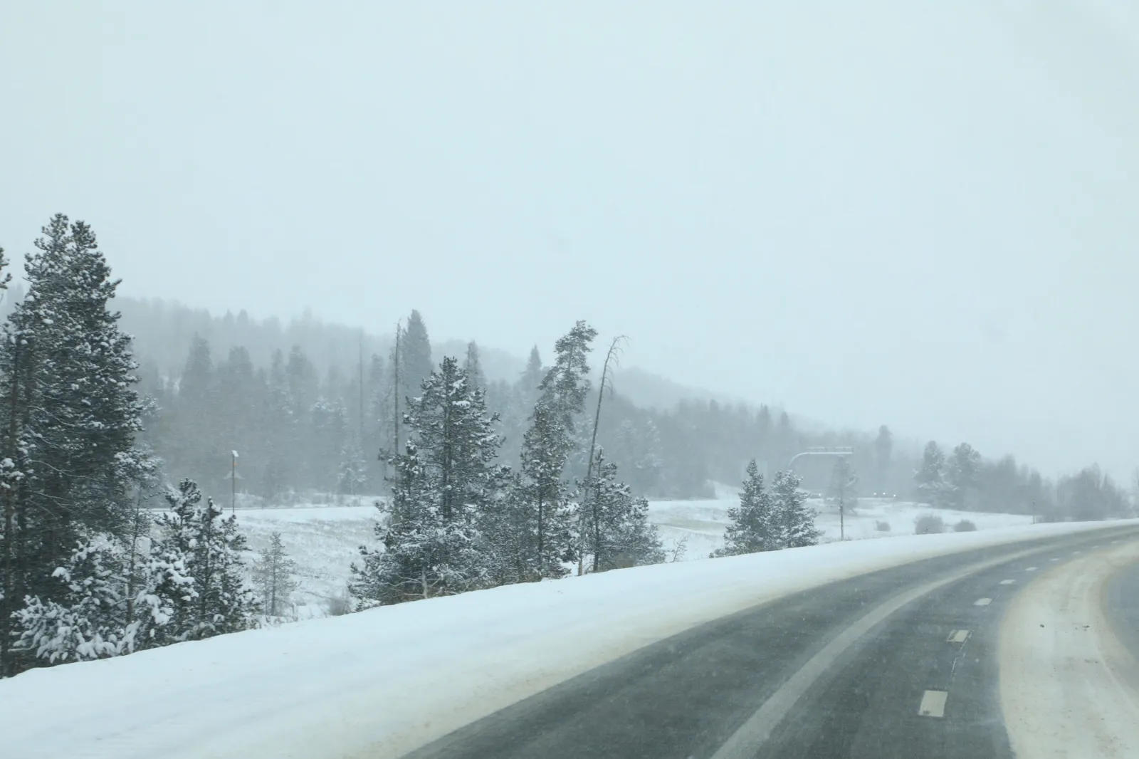
A powerful late-season winter storm is set to slam parts of Wyoming and Colorado, bringing up to 20 inches of snow and wind gusts as high as 60 mph, according to the National Weather Service (NWS).
The system is expected to create dangerous travel conditions, near-zero visibility at times, and potential power outages from heavy, wet snow weighing down trees and power lines.
With warnings covering multiple mountain ranges and nearby communities, the storm is likely to significantly disrupt daily life, including Monday commutes, travel plans, and potentially local school operations in harder-hit regions.
Local Impacts: Power, Trees, and Daily Disruptions
Beyond travel, the winter storm could create localized disruptions across affected communities, including:
- Power outages, caused by heavy snow sticking to tree branches and power lines.
- Significant impacts expected for Monday morning and evening commutes.
- Difficulty accessing rural and mountainous areas.
- Possible delays or disruptions to schools and local services, especially in high-elevation communities.
- Hazardous conditions for outdoor work and outdoor activities.
- Tree damage, particularly in areas where trees have already grown their spring leaves.
Winter Storm Overview: The Hardest-Hit Areas
The NWS has issued winter storm warnings across large sections of Wyoming and Northern Colorado, particularly targeting higher elevations and mountain corridors.
The most impacted areas include:
Colorado (above 9,000 feet)

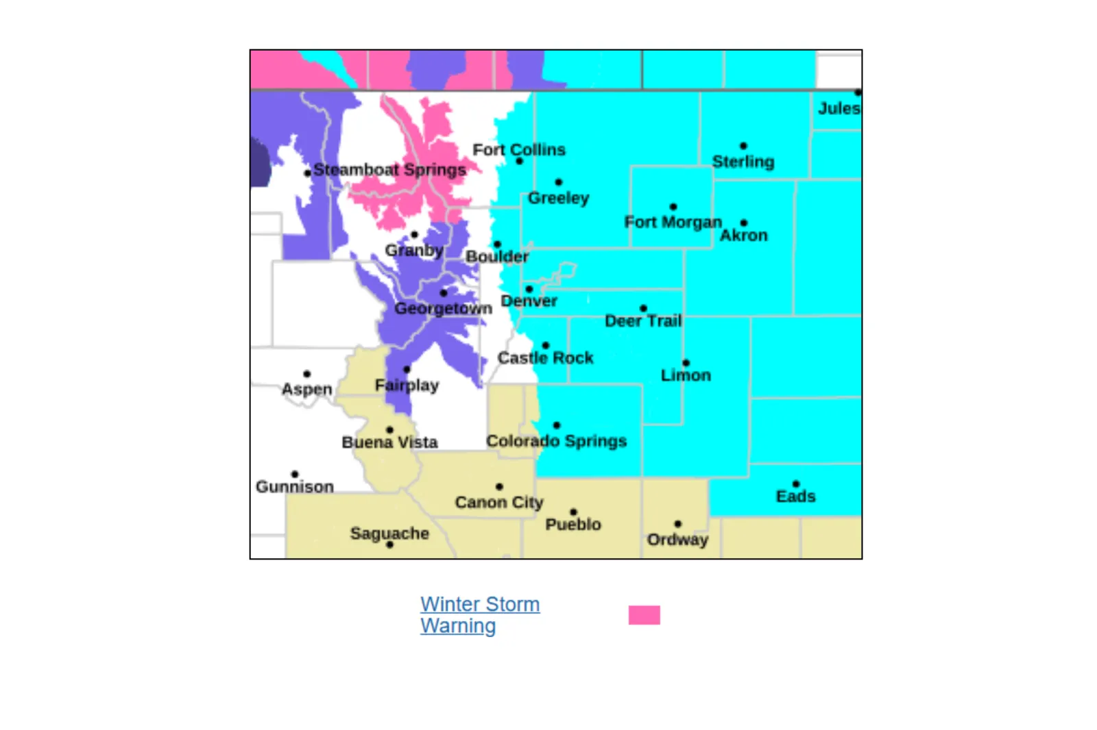
- Rocky Mountain National Park
- Medicine Bow Mountains
- Rabbit Ears Range and surrounding Mountain Passes
Wyoming
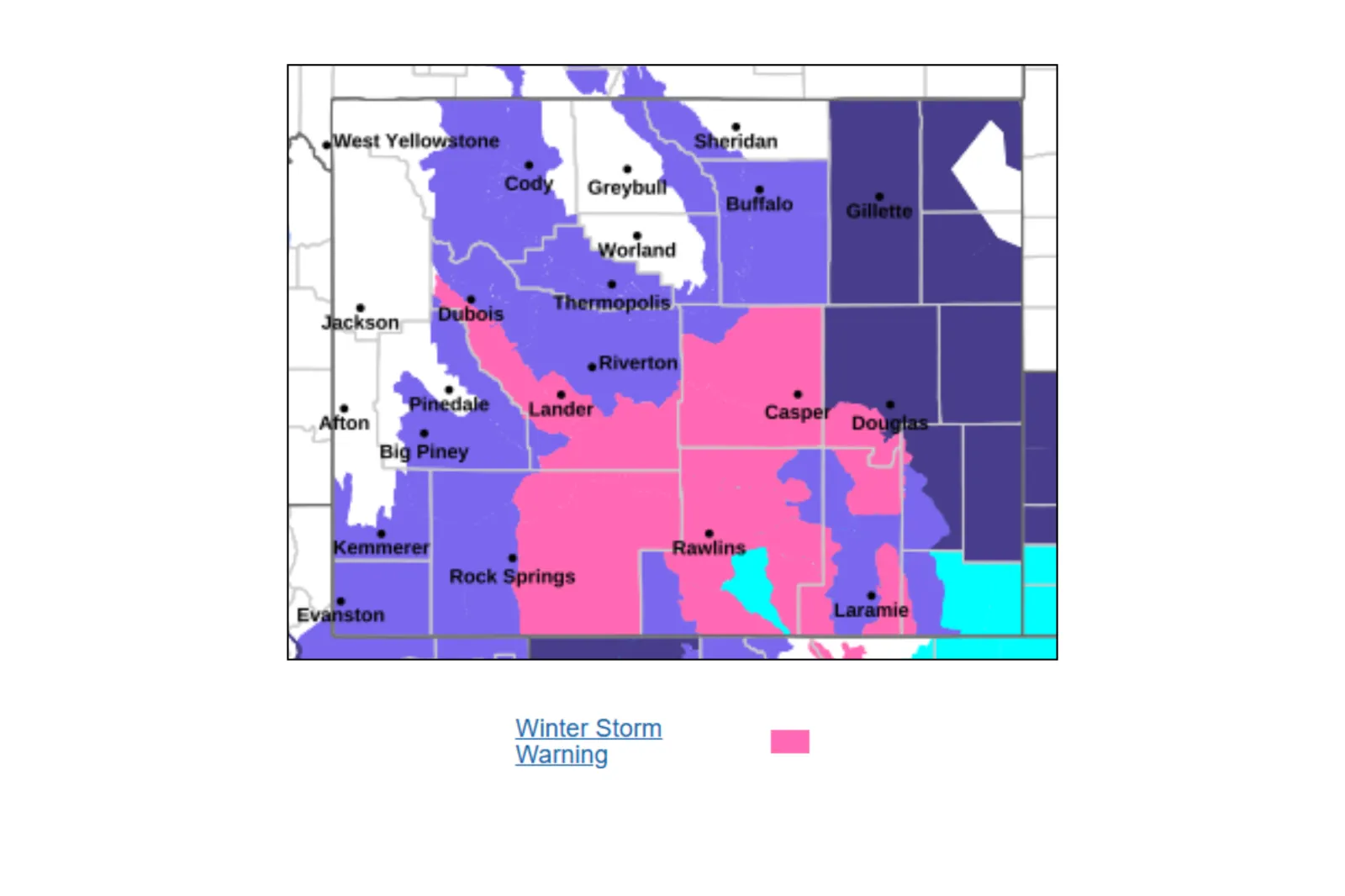
- Snowy Range and the north Laramie Ranges
- Wind River Mountains
- Sierra Madre Range
- Casper Mountain and the surrounding areas
- Interstate 80 corridor near Arlington and Elk Mountain
Forecast Winter Weather Conditions
- Heavy, wet snow capable of clinging to trees and infrastructure.
- Strong winds ranging from 30 to 60 mph.
- Blowing and drifting snow, which is likely to reduce visibility.
- Rapidly deteriorating conditions through Sunday night into Monday.
How Much Snow Is Expected?
Snow totals will vary widely by elevation and location, but the NWS is warning of substantial accumulations across multiple regions in both states.
Colorado
Rocky Mountain National Park and the Medicine Bow Range:
- Between 8 and 18 inches of snow.
- The highest totals are expected across the east-facing slopes.
Wyoming
Snowy Range and north Laramie Range:
- 10 to 20 inches of snow.
- Winds up to 40 mph could cause blowing snow, especially in areas above 8,500 feet.
Wind River Mountains (East):
- Between 9 to 18 inches of snow, with higher amounts expected locally.
- Wind gusts reaching up to 60 mph.
Casper Mountain:
- Between 10 and 18 inches of snow.
- Winds reaching 40 mph are expected to create blowing snow, which will reduce visibility.
Sierra Madre Range:
Snow Warnings: What Should Drivers Expect?
Travel is expected to become “very difficult to impossible,” especially in high-elevation areas, and along major transport routes.
Key travel concerns:
- Snow-covered and icy roads, especially over bridges and overpasses.
- Blowing snow and whiteout conditions.
- Sudden drops in visibility, in some cases, below a quarter of a mile.
- Increased risk of stranded vehicles.
Major routes impacted:
- Interstate 80 in Wyoming, near Arlington, Elk Mountain, and the Laramie Range.
- Highway 20 to 26 between Hiland and Casper, in Wyoming.
- Mountain passes, including Cameron Pass, Willow Creek Pass in Colorado, and South Pass in Wyoming.
The NWS is urging drivers to delay travel if possible, but if it’s necessary, they should:
- Carry emergency supplies, including food, shovels, water, and a flashlight.
- Allow extra time and space between vehicles.
- Prepare for rapidly changing conditions.
Key Takeaway
This storm represents a high-impact, late-season winter event, with heavy snow, strong winds, and widespread travel hazards across Wyoming and Northern Colorado. Residents in affected areas are urged to prepare now and avoid unnecessary travel, as conditions are expected to rapidly worsen through Monday.
Read the full article here


