


Severe thunderstorms are expected to redevelop across parts of Oklahoma and the southern Plains, with forecasters warning that large hail—potentially up to golf ball size—and damaging winds could accompany storms moving through the region from Friday evening into the night.
The renewed threat comes less than 24 hours after a confirmed tornado tore through Enid, Oklahoma, flattening homes and prompting search‑and‑rescue operations, as another round of potentially severe weather takes shape along an approaching cold front.
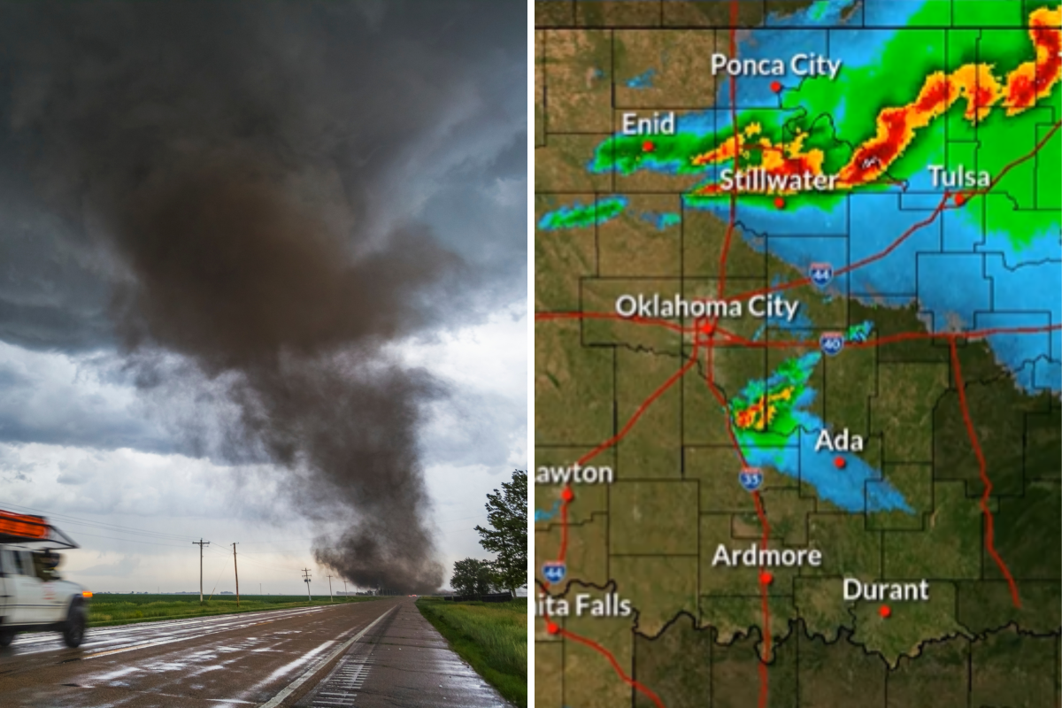
The National Weather Service (NWS) in Norman warned that conditions remain favorable for strong to severe storms, particularly across north‑central and central Oklahoma.
Oklahoma: Large Hail and Damaging Winds Expected
According to the NWS in Norman, thunderstorms are expected to continue developing across north‑central Oklahoma, with isolated storms possible farther south into central parts of the state.
In a post on X, the agency said heavy rainfall, strong winds and hail are all possible as storms move across northern Oklahoma, driven by a cold front approaching from the north.
Forecasters said the primary hazards Friday into Friday night will be:
- Large hail, potentially reaching golf ball size
- Damaging wind gusts
- Localized heavy rainfall
Forecasters warned storms may intensify quickly Friday evening as they move south across northern Oklahoma.
Tornado Strikes Enid As Storm Threat Lingers
The renewed severe weather risk follows a confirmed tornado that struck southeastern Enid on Thursday evening, causing widespread damage.
At 8:21 p.m., the NWS confirmed a strong tornado moving across parts of the city and toward Fairmont.
In a follow‑up update, the agency warned that although rotation weakened, the tornado was still capable of causing significant damage.
KOCO News Chief Meteorologist Damon Lane, tracking the storm live, described it as “the strongest storm we have seen in a very long time here in Oklahoma,” warning viewers it represented a “worst‑case scenario.”
Video from the area showed homes flattened and large amounts of debris strewn across the neighborhood.
Local officials said deputies were deployed for search and rescue efforts, while first responders urged residents to stay clear of damaged areas to allow emergency crews to operate safely.
Why Friday’s Threat Matters
Forecasters stressed that while Thursday’s tornado has passed, the broader severe weather pattern has not ended.
The NWS warned that strong to severe storms are likely to redevelop along the same cold front Friday evening, particularly across northern Oklahoma and into nearby parts of Kansas and Texas.
Large hail and damaging winds are the main concerns and officials urged residents to remain alert, noting that conditions can change rapidly, especially during evening and overnight hours when visibility is reduced.
What Comes Next
Storms are expected to move east overnight, but forecasters cautioned that additional rounds of severe weather remain possible into the weekend as the system continues to progress across the southern Plains.
With already‑damaged communities now facing renewed storm threats, officials emphasized staying weather‑aware and avoiding unnecessary travel during severe warnings.
Read the full article here


