


NEW YORK – If the weekend forecast in the Northeast sounds familiar, that’s because it is. More rain and thunderstorms are expected across the region, marking the sixth out of the past seven weekends that precipitation is in the forecast.
Due to the front’s slow advancement, much of Saturday could remain relatively dry along the I-95 corridor as temps soar into the 80s, making it feel more like summer. But storms are likely to break out across the interior Northeast and mid-Atlantic Saturday afternoon before racing toward the coast during the evening hours.
Any storms that do develop in this unstable environment will have the ability to produce damaging winds and some large hail, prompting a level 1 out of 5 risk on NOAA Storm Prediction Center’s Severe Weather Outlook scale for Saturday. An upgrade to the risk can’t be ruled out given the dynamics at play, according to the FOX Forecast Center.
“So, Saturday, we do have the risk of some thunderstorms,” FOX Weather Meteorologist Melissa Torres said. “And that goes from Boston all the way down into the northern part of Florida.”
That includes the Philadelphia area into Boston and Washington, D.C.
“It’s going to be really rumbly for the City of Brotherly Love,” said FOX Weather Meteorologist Britta Merwin. “Any sort of outdoor plans (Saturday) night should really be (re)considered.”
The FOX Forecast Center said that there is high confidence that it will rain on Saturday, but details beyond that remain extremely uncertain.
The dreaded ‘cutoff low’ looms for next week
As we get into Sunday, the forecast gets tricky as confidence is increasing in a stalled low pressure center breaking off from the main flow of the jet stream and meandering over the Ohio Valley for several days.
This type of setup is a hallmark for long-duration rain events as the counterclockwise flow around the low works in tandem with clockwise flow around a high pressure center that’s blocking it to the east. This persistent wind flow aloft creates a funnel of atmospheric moisture out of the south that remains fairly stationary for several days.
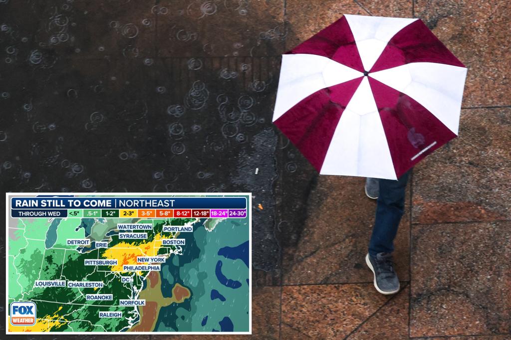
While it’s too soon to forecast the exact placement of the heaviest rain, a widespread area of 2 inches or more can be expected from the mid-Atlantic into the Northeast and some areas pushing 3-5 inches of rain by the time the storm is over.
It won’t rain every minute of the day, but several rounds of showers with embedded downpours can be expected from Sunday through at least Tuesday as this stubborn low takes its time to dissipate before it eventually moves out of the region sometime after Wednesday.
The FOX Forecast Center says although the rain will initially be beneficial given the ongoing areas of drought, heavier rain late Sunday into Monday and again on Tuesday could pose the risk for some instances of flash flooding.
NOAA’s Weather Prediction Center has issued a multiday flood outlook from Saturday through Monday that includes Charleston, West Virginia; Washington, D.C.; New York City, and Hartford, Connecticut.
Read the full article here


