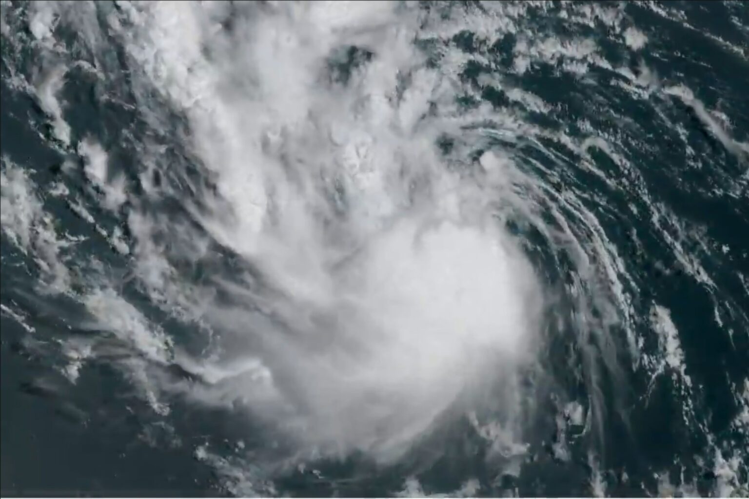
Satellite imagery has captured Tropical Storm Erin—which the National Hurricane Center (NHC) expects to become a hurricane by Friday—moving over the Atlantic Ocean.
A meteorologist told Newsweek, “There is a window of opportunity where Erin could explode into a Category 4 hurricane in the Atlantic this weekend or early next week.”
Why It Matters
Forecasters predict Erin may become the first major hurricane of the 2025 season.
It’s the fifth named storm in the Atlantic so far, after Andrea, Barry, Chantal, and Dexter—none of which reached hurricane strength.
Chantal brought heavy rain and flooding to North Carolina in early July.
What To Know
Satellite imagery shared to social media by the Cooperative Institute for Research in the Atmosphere (CIRA) on Wednesday showed the system swirling over the waters of the Atlantic Ocean.
Tropical Storm Erin showing some signs of life this morning as convection fires within.
Erin is still forecast to become a major hurricane over the weekend. pic.twitter.com/fNTeNUUToJ
— CIRA (@CIRA_CSU) August 13, 2025
“Tropical Storm Erin showing some signs of life this morning as convection fires within,” it said. “Erin is still forecast to become a major hurricane over the weekend.”
In its most recent advisory for Tropical Storm Erin, the NHC said the system was moving west at around 17 miles per hour, with maximum sustained winds near 60 mph.
“A turn toward the west-northwest is expected tonight, with this motion expected to continue into the weekend,” the agency said.
“On the forecast track, the center of Erin is likely to move near or just north of the northern Leeward Islands over the weekend.”
The NHC warned that swells generated by the storm could begin impacting parts of the northern Leeward Islands, the Virgin Islands and Puerto Rico by this weekend, adding that these were likely to lead to “life-threatening surf and rip current conditions.”
What People Are Saying
AccuWeather lead hurricane expert Alex DaSilva said, in an advisory shared with Newsweek on Thursday: “Erin is moving into an area of the Atlantic primed for rapid intensification. The waters are incredibly warm. There’s little disruptive wind shear, dry air, or dust to slow this storm down.
“Erin is forecast to strengthen into a Category 1 hurricane by Friday afternoon and then rapidly intensify into a Category 3 hurricane by Saturday afternoon. There is a window of opportunity where Erin could explode into a Category 4 hurricane in the Atlantic this weekend or early next week.”
ABC News chief meteorologist and chief climate correspondent Ginger Zee on X, Thursday: “Tropical Storm #Erin is now less than 1000 miles from the Virgin Islands- looks like it becomes a hurricane by late Friday then could rapidly intensify passing just north of Puerto Rico.
“High surf & rip currents this weekend in the Leeward Islands. THEN the Bermuda high steering the storm should weaken allowing it to turn north even more, most models keeping it off the east coast.
“However, this is still a week away so from Bermuda to the outer banks, enjoy your weekend but watch carefully for every deviation west & east to see impacts for next week.”
What Happens Next
Agencies such as the NHC issue regular forecast updates.
Read the full article here

