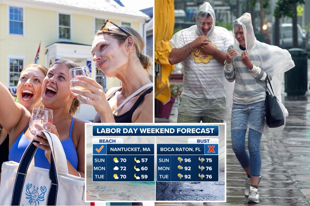
As Americans celebrate summer’s last big weekend, a vast majority of the nation will do so without significant weather impacts. But Mother Nature does look to dampen the holiday weekend spirits for parts of the Plains and Gulf Coast.
While dry elsewhere, much of the U.S. will be running cooler than average, which may make those last-minute vacations feel a bit brisk. Below-average temperatures are expected to settle in through at least Labor Day.
Saturday: Sunshine State becomes the soggy state
As we begin the weekend, let’s get to the bad news first. Rain chances are up across Florida and the southern and northern Plains on Saturday and Sunday.
Florida’s soggy stretch with afternoon thunderstorms might limit beach time for some, but early risers can still hit the sand with plenty of time left in the day.
The highest rainfall totals are along the Atlantic beaches, with 2-3 inches possible by the end of the weekend near Miami and Fort Lauderdale.
Meanwhile, a low-pressure system will begin its slow trek from the Rockies into the Plains on Saturday. With daytime heating and plentiful moisture being pulled north, afternoon storms will develop with high rainfall rates that will increase the flooding risk, according to the FOX Forecast Center.
Rainfall rates may reach 1-2 inches per hour. A level 2/4 flash flood risk exists across South Dakota, Nebraska and Kansas.
Saturday will be the busiest travel day of the weekend.
“The worst times to drive over the holiday weekend are typically in the afternoon and early evening,” the AAA said. “Saturday is expected to be extra busy with many drivers heading out of town or taking day trips.”
Meanwhile, it’s warm and dry in the West and Great Lakes.
Sunday: Clear across the mid-Atlantic
In the mid-Atlantic, the FOX Forecast Center has pegged Ocean City, Maryland, as a true winner for the weekend. With high temperatures in the lower 70s and no rain, it will be a perfect beach weekend to say farewell to summer.
Meanwhile, Hilton Head, South Carolina, is looking at higher rain chances on Sunday and Labor Day.
Farther west, a stalled front will keep things rainy throughout most of the week across the Southwest and southern Plains.
NOAA’s Weather Prediction Center has put a bull’s-eye in the nation’s heartland for continued risk of flash flooding.
Flash flooding is possible across this area as rain and storm chances continue through Monday.
Meanwhile, farther south, scattered showers and thunderstorms will roam around large swaths of Texas and New Mexico, but no severe weather is expected. In fact, NOAA’s Storm Prediction Center wasn’t highlighting any area in the nation for a severe weather risk throughout the holiday weekend.
Labor Day: Cooler for many, still hot for West Coast
Labor Day Monday again looks tranquil for just about the entire nation, with pleasant conditions across much of the Northeast and the West Coast. For the East, relatively cool air will continue to push in from Canada, leaving temperatures about 10-15 degrees below average.
Scattered showers still dot the weather map across the Plains and Mississippi Valley back into Texas and the Desert Southwest, but no severe or overwhelming rains are predicted.
The West will remain warm-to-hot with 90s expected in Southern California up through the Intermountain West and into Montana.
As far as the tropics go, FOX Weather Hurricane Specialist Bryan Norcross said overall conditions are hostile to any development.
“Most likely, significant development won’t restart until the second week or maybe the middle of September.”
Read the full article here

