


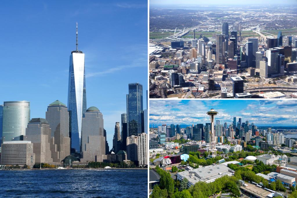
New York, Dallas and Seattle are among American cities that are SINKING, reveals new research.
An analysis of 28 urban areas in the United States revealed that all of them are falling in altitude, potentially affecting 34 million people.
The cities are sinking by 0.08 to 0.4 inches per year, according to new research published in the journal Nature.
The major cause is groundwater extraction, say scientists.
The Virginia Tech study used satellite-based radar measurements to create high-resolution maps of subsidence, or sinking land, for 28 of the most populous American cities.
The cities are home to 34 million people, around 12% of the total US population.
At least 20% of the urban area is sinking in every city studied – and in 25 of the 28 cities, at least 65% is sinking.
Study lead author Leonard Ohenhen warned that when land shifts downward, even just a little bit, the structural integrity of buildings, roads, bridges and dams can be “profoundly” impacted.
Ohenhen, a geosciences graduate student who worked with Associate Professor Manoochehr Shirzaei [CORRECT] at Virginia Tech’s Earth Observation and Innovation Lab, said: “A lot of small changes will build up over time, magnifying weak spots within urban systems and heighten flood risks.”
New York, Chicago, Seattle, Denver, and five other cities are sinking at around 0.08 inches per year.
Several cities in Texas showed some of the highest measured rates of subsidence at about 0.2 inches per year — and as much as 0.4 inches per year in certain areas of Houston.
Some localized zones are sinking faster than nearby areas, according to the findings.
The researchers say the phenomenon represents one of the more harmful yet least visible effects of subsidence.
Professor Shirzaei explained that, unlike flood hazards, where risks manifest only when land sinks below a critical threshold, inconsistent land motion can crack and destabilize buildings, foundations, and infrastructure.
His team assessed how infrastructure risks increase when subsidence rates vary.
Other cities with high subsidence variability include New York, Las Vegas, and Washington, D.C.
Shirzaei said: “The latent nature of this risk means that infrastructure can be silently compromised over time with damage only becoming evident when it is severe or potentially catastrophic.”
He added: “This risk is often exacerbated in rapidly expanding urban centres.”
The researchers said that as cities continue to grow, so too does the demand for freshwater.
If water is extracted from an aquifer faster than it can be replenished, it can crumble and compact in the ground.
Shirzaei said: “The compounding effect of shifts in weather patterns with urban population and socioeconomic growth is potentially accelerating subsidence rates and transforming previously stable urban areas into vulnerable zones for flooding, infrastructure failure, and long-term land degradation.”
The study highlighted the importance of integrating land subsidence monitoring into urban planning policies to prevent worsening infrastructure risks, and recommended targeted “mitigation and adaptation” strategies.
These include groundwater management to reduce excessive withdrawals, enhanced infrastructure resilience planning to account for differential subsidence, and long-term monitoring frameworks for early detection and intervention
Read the full article here


