


Tornado warnings blared across central and eastern North Dakota on Friday night, as a series of dangerous storms prompted the National Weather Service (NWS) to urge thousands of residents to “TAKE COVER NOW.”
Why It Matters
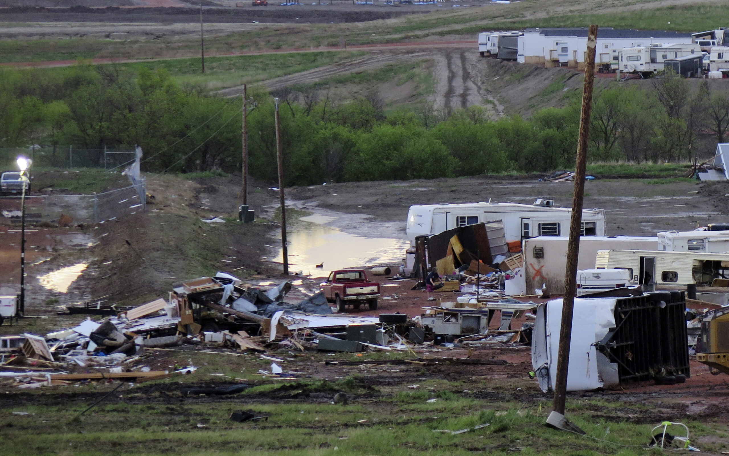
Tornadoes are among the most violent and unpredictable weather events. With wind speeds ranging from 65 to over 200 mph, they can damage buildings, uproot trees, and pose serious risks to people caught without adequate shelter. One of the primary dangers comes from flying debris, which can cause injury or damage property.
What To Know
The most severe warning came from the NWS in Bismarck, which issued a tornado warning until 9:30 p.m. CDT for multiple counties, including McLean, Burleigh, Morton, and Oliver. At 8:55 p.m., a rotating thunderstorm capable of producing a tornado was located near the town of Center, moving northeast at 60 mph.
Forecasters warned of a tornado and quarter-sized hail, noting: “Flying debris will be dangerous to those caught without shelter. Mobile homes will be damaged or destroyed.”
Earlier in the evening, the NWS maintained tornado warnings for Morton County, where a storm near New Salem was racing east at 65 mph. Similar warnings were in effect for Stutsman, LaMoure, and Barnes counties, where storms brought baseball-sized hail.
One particularly dangerous cell was located 5 miles north of Spiritwood, moving northeast with hail as large as 3 inches and the potential for a tornado. Other communities in the path included Eckelson, Montpelier, and Nortonville.
The storm system also impacted drivers on Interstate 94, with tornado threats extending near key travel corridors.
Residents were repeatedly warned to take shelter immediately: “Move to a basement or an interior room on the lowest floor of a sturdy building. Avoid windows. If you are outdoors, in a mobile home, or in a vehicle, move to the closest substantial shelter and protect yourself from flying debris.”
Meanwhile, a tornado warning is still in place for parts of North Dakota and Minnesota.
The National Weather Service issued a moderate risk alert for severe thunderstorms across parts of North Dakota and Minnesota, warning that conditions could lead to tornadoes, damaging winds, and large hail throughout Friday evening and overnight.
A fast-moving line of storms is sweeping across the northern Plains and upper Mississippi Valley, with forecasters especially concerned about tornado activity in eastern North Dakota and north-central Minnesota. The storms are being fueled by a mix of warm, moist air, strong winds aloft, and an approaching low-pressure system—all of which are making the atmosphere increasingly unstable.
The Storm Prediction Center said supercell storms, which can produce tornadoes, may develop ahead of a larger storm system known as a mesoscale convective system (MCS). These supercells could bring large hail, damaging wind, and potentially strong tornadoes, especially in areas near the North Dakota-South Dakota-Minnesota border.
Later in the evening, the storms could grow into a derecho—a fast-moving windstorm that can cause widespread damage. Wind gusts as high as 85 to 105 mph are possible as the system moves toward northern Wisconsin and Michigan’s Upper Peninsula.
Officials urged people in cities like Jamestown, Grand Forks, and Fargo to stay alert.
What People Are Saying
NWS Bismarck said on X: “Isolated severe thunderstorms are possible again today. However, the areas most likely to see severe weather are the northwest and north central. The primary threats is hail as large as quarters and 60 mph wind gusts.”
What Happens Next
The situation may worsen as the evening progresses. The ongoing thunderstorms are expected to organize into a broader system, with the potential to evolve into a derecho—a long-lived windstorm capable of producing widespread wind damage. Wind gusts between 85 and 105 mph are possible along the MCS track as it pushes into northern Wisconsin and the western Upper Peninsula of Michigan.
Read the full article here


