


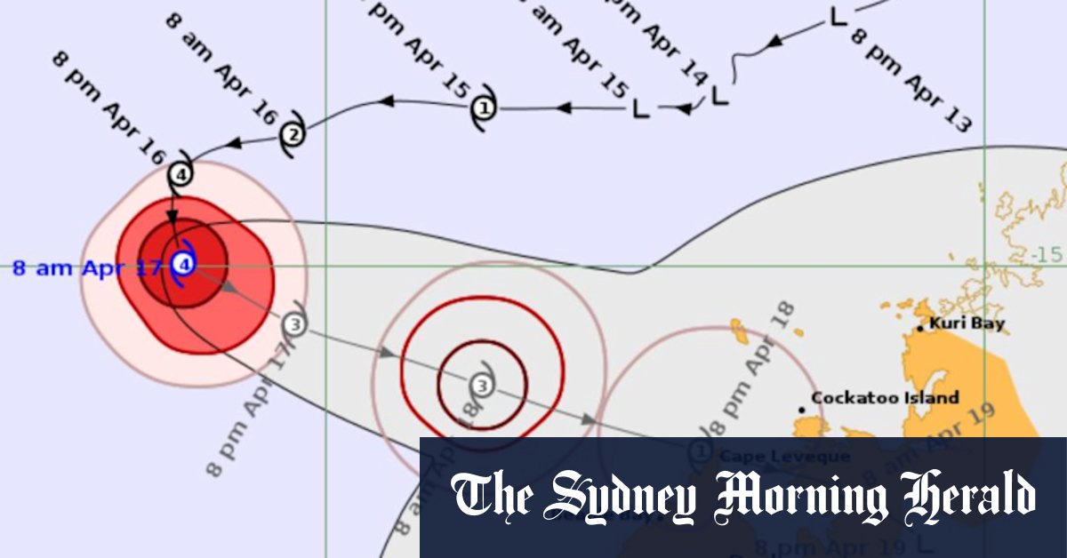
A cyclone has strengthened to a category four system after making a sharp U-turn towards regional communities already battered by an earlier weather event.
Tropical Cyclone Errol is offshore about 500 kilometres northwest of Broome and is beginning to track towards the West Australian coast, expected to bear down on the Easter weekend.
The system intensified overnight to a category four system – the second-highest classification that could cause structural damage from severe winds, power loss and a high storm surge.
Errol had been heading west away from Australia before it made a sharp U-turn and is now moving towards the northwest coast.
Forecasters expect Errol to move slowly southeast, maintaining a category four strength on Thursday.
It will take days for Errol to reach the coast and no significant wind or rain is forecast on Thursday but communities may start to feel the effects in the coming days.
Conditions will ramp up for the Kimberley on Good Friday, while the system will begin weakening and is expected to drop to a category one by the time it nears the coast.
“It’s still expected to bring strong to damaging winds, heavy rain, thunderstorms from Friday afternoon through until Saturday,” meteorologist Angus Hines said.
Errol will likely arrive somewhere around the northern tip of the Dampier Peninsula on Saturday morning as a category-one system.
Read the full article here


