


National Weather Service (NWS) meteorologists in Southern California warned that some parts of the state could face significant debris flows and flash flooding on Tuesday amid bouts of heavy rainfall.
Newsweek reached out to the NWS office in Los Angeles by phone for comment.
Why It Matters
A Pacific storm is bringing bouts of heavy rain to low-elevation parts of Southern California on Tuesday. The storm is also bringing heavy snow to the Sierra Nevada, with snowfall totals forecast to be in excess of 3 feet in some parts of the mountain range. Mountain snow typically begins in October, but such high amounts so early in the season are unusual, NWS meteorologist Stephen McCoy previously told Newsweek.
What To Know
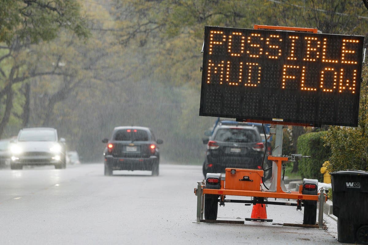
One of the most dangerous threats for Southern California will be the risk of debris flow as the rain floods recent burn scars, including the Eaton Scar and Bridge Scar. More than 3 inches of rain could fall in these areas.
On Monday, the NWS office in Los Angeles published a rainfall total map from the storm, which estimated that as much as 3.5 inches of rain could fall on the Eaton Scar and 3.2 inches on the Bridge Scar. Numerous other wildfire scars will also be hammered by heavy rain.
The heavy rain heightens the risk of debris flows, including mudslides and rock slides.
“Low-moderate risk of SIGNIFICANT flash flooding/debris flows across recent burn scars,” the map said. “High risk for rockslides/mudslides and urban roadway flooding.”
Burn scars increase the risk of flash floods because “burned soil can be as water-repellant as pavement,” the NWS said in a webpage about burn scars. In cases where rainfall would normally be absorbed, water runs downstream, putting nearby communities at risk of debris flows.
Numerous weather alerts remain in place across Southern California, including a severe thunderstorm watch, special marine warning, flash flood watch, and others.
What People Are Saying
NWS Los Angeles, in a flash flood watch: “Heavy rainfall over the Bridge, Line, Apple, El Dorado and Airport burn scar Rainfall rates of 0.40 to 0.90 inch per hour are expected up to and during the period of the watch. Residents near the Bridge, Line, Apple, El Dorado and Airport burn scar should prepare for potential flooding impacts. Be sure to stay up to date with information from local authorities. Heavy rainfall could trigger flash flooding of low-lying areas, urbanized street flooding, and debris flows in and near recent wildfire burn scars.”
NWS, in a Tuesday forecast: “The storm will produce rain over Central California and heavy rain over parts of Southern California…The associated heavy rain will cause mainly localized flash flooding, with urban areas, roads, small streams, and low-lying areas being the most vulnerable. The flooding may include debris flows in or near recently burned areas. Moreover, heavy snow will develop over the Sierra Nevada Mountains on Tuesday, tapering off by Wednesday.”
What Happens Next
The storm will continue through Tuesday, with most alerts set to expire by Tuesday afternoon. People living in Southern California should follow the guidance of local weather officials.
Read the full article here


