


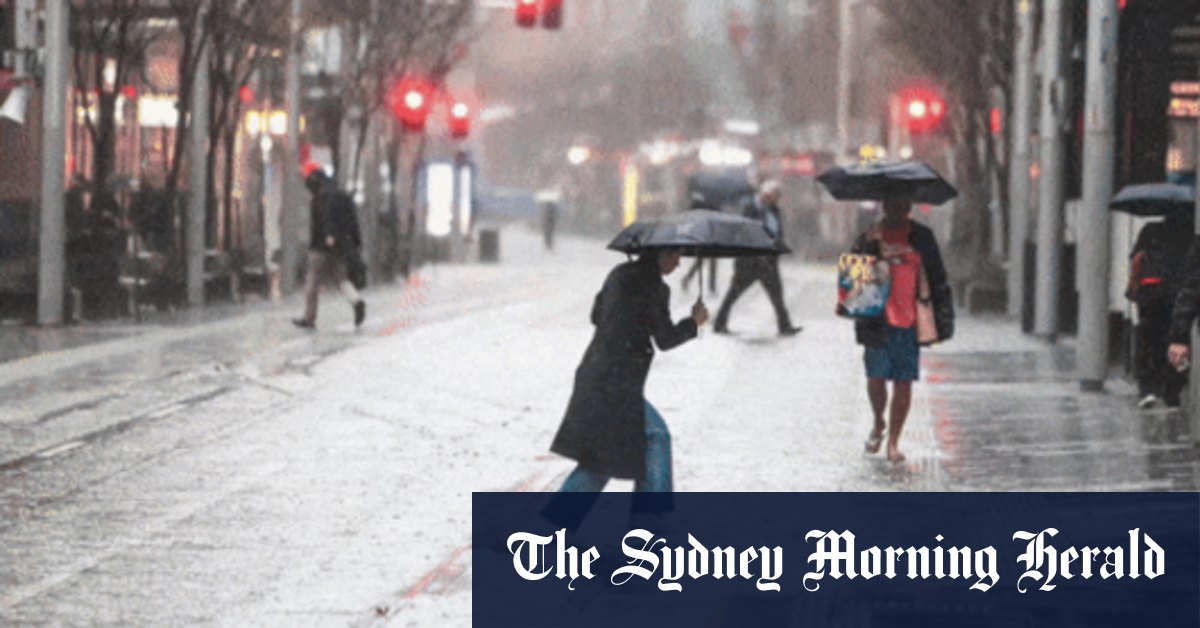
According to the Bureau of Meteorology, widespread showers are expected to continue along NSW’s north coast on Friday, though they are forecast to ease throughout the day, with isolated showers also forecast elsewhere in the state’s east. Possible thunderstorms are expected along the north coast, as well as localised heavy falls.
Loading
The rain is expected to ease on Saturday, with some isolated showers forecast in NSW’s east. Sunday will also see a chance of showers along NSW’s coast and ranges.
What about summer and Christmas?
Sydney’s unusually wet August is only one month of the four that the Bureau of Meteorology has predicted, with a 60 to 80 per cent chance, will have above-average rainfall. Until the end of November, most of the continent, apart from the west and far south-east, is set to be wetter than usual.
One reason, separate from this week’s weather event, is the Indian Ocean Dipole, which is currently neutral but according to the Bureau of Meteorology is increasingly likely to develop into a negative event in the coming months.
As of August 12, all international models, including the Bureau of Meteorology’s, have been expecting a negative Indian Ocean Dipole event to hit in spring, and, as is consistent with the climate pattern’s lifecycle, return to neutral in early summer. In short, indicators suggest it will likely be a wet summer and potentially raining on Christmas Day.
“The probabilities are that it will be wet… it’s not cut and dried.”
Long-range forecasting is based on probabilities, McDowell says, noting how we are “very likely” to see above median rainfall across Sydney and the wider state through spring, but it doesn’t mean everywhere will be wet all the time.
“There’s going to be dry days. There’s going to be sunny days. There is going to be beach days,” says McDowell. “But on average, we’re probably going to see more rainy days and more rainfall, when it does fall, than we would normally expect.”
McDowell emphasises that a negative Indian Ocean Dipole would not be the only thing causing wet weather, it just increases the probability of wet weather across New South Wales.
He highlights warm sea surface temperatures in the Tasman, a potentially more positive Southern Annular Mode, and climate change as other factors contributing to the wet forecast – though he acquiesces that the negative Indian Ocean Dipole is “probably a far bigger contributor” to the wet forecast than its celebrity counterpart. Yes, we’re talking about La Niña.
Are we in La Niña or heading for another La Niña?
Another climate pattern that can bring above-average rainfall to parts of central and eastern Australia is La Niña, which is part of the El Niño–Southern Oscillation (ENSO).
Characterised by cooler than average sea surface temperatures in the tropical Pacific Ocean, La Niña, which is the opposite of El Niño, can also bring a higher risk of flooding during the warmer months, and increase the likelihood of tropical cyclones. Ex-tropical Cyclone Alfred in March did not occur in La Niña – ENSO has been neutral since April 2024, with the previous La Niña ending in February 2023 – though 2017’s Cyclone Debbie occurred during a La Niña period.
Loading
The record-breaking northern NSW and south-east Queensland floods in 2021 were also influenced by La Niña, with the climate pattern likely becoming more frequent and intense due to climate change.
In December, the Bureau of Meteorology moved away from doing ENSO alerts in favour of the long-range forecast, which McDowell says is more accurate as “it takes in the whole state of the oceans and the atmosphere and everything, and the coupling and the feedback between the two.”
“It’s massively complicated dynamical system,” he says of long-range forecasting, of which ENSO is only one part (sea surface temperatures and Indian Ocean Dipole also contribute).
“La Niña can give us some guidance about long-range forecasting, but not all La[s] Niñas are wet, and not all La[s] Niñas are the same, so just by focusing on that one indicator, it doesn’t give us the full picture,” says McDowell.
Although NOAA predicted La Niña would arrive in September, the Bureau of Meteorology is reluctant to take a firm position at this stage. Per the Bureau of Meteorology, ENSO is expected to remain neutral until January at least.
“Climate change over the oceans has impacted La Niña forecasting as well, so maybe traditional methods of looking at La Niña aren’t as reliable as they used to be,” says McDowell. “NOAA have slightly lower thresholds than we do, so we would need to see a stronger signal for to be forecasting or declare La Niña.”
With Caitlin Fitzsimmons, Josefine Ganko, Emily Kaine.
Read the full article here


