


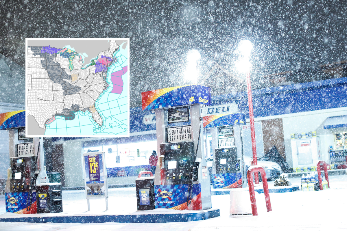
A sprawling winter storm continues to hammer parts of the country, with warnings in effect from the Northeast to the Rockies and Alaska.
The system is expected to dump up to 18 inches of snow in some areas, accompanied by strong winds and icy conditions.
Forecasters warn of dangerous travel, slick roads, and poor visibility as snow and mixed precipitation persist through the weekend and into early next week.
Alerts remain in effect through late Saturday in most affected regions, with some extending into Monday. Officials warn of dangerous travel, poor visibility, and potential power outages.
National Weather Service (NWS) winter storm warnings impacting at least ten states have been issued as a result of the massive winter storm sweeping across the U.S.
Northeast
Connecticut
Hartford County remains under a warning until 10 a.m. Saturday, with up to an inch of additional snow. Middlesex, New London, Fairfield, New Haven, and Litchfield counties face heavy snow or mixed precipitation through early afternoon, with up to two inches of snow and a light glaze of ice. Roads and bridges will be slick, and visibility may drop below a quarter mile. The NWS says: “Roads, and especially bridges and overpasses, will likely become slick and hazardous.”
Massachusetts
Western Hampden County is under a warning until 10 a.m., while the Berkshires could see up to two inches of snow through early afternoon. Travel will be hazardous as snow tapers to flurries later in the day.
New York
Warnings cover the Capital Region, Mohawk Valley, Catskills, and Taconics until early afternoon, with up to two inches of snow. Central and southern counties, including Oneida, Onondaga, and Sullivan, expect storm totals of six–12 inches before snow ends by daybreak. Long Island and New York City boroughs remain under warnings until 1 p.m., with light snow and ice creating treacherous conditions.
New Jersey
Eastern Passaic, Hudson, Essex, and Union counties face heavy mixed precipitation through early afternoon, with slick roads and icy patches.
Pennsylvania
Northern Wayne and Pike counties remain under warnings until 7 a.m., with snow, sleet, and light ice accumulation. The NWS says: “If you must travel, keep an extra flashlight, food, and water in your vehicle in case of an emergency.”
Rockies and West
Colorado
Rabbit Ears Pass, and the Elkhead and Park Mountains could see six–18 inches of snow and gusts up to 45 mph through early Sunday. Wolf Creek and Cumbres Pass may pick up six–12 inches, with winds near 50 mph, making travel extremely difficult.
Idaho
Mountain regions, including Sawtooth Basin and Sun Valley, expect 8–18 inches of snow through Saturday, with gusty winds creating hazardous conditions. “If you must travel, keep an extra flashlight, food, and water in your vehicle in case of an emergency. Call 5 1 1 or visit 511.idaho.gov for the latest road conditions,” the NWS says.
Wyoming
The Sierra Madre Range braces for 12–18 inches of snow and winds up to 45 mph through Sunday morning. Officials warn outdoor recreation could become life-threatening.
California
Mono County remains under a warning until early Saturday, with up to 18 inches of snow at higher elevations and wind gusts topping 80 mph along ridges.
Alaska
The Panhandle faces the most severe impacts, with Yakutat expecting up to 45 inches of snow and Juneau up to 34 inches through Monday. Skagway and Haines could see 18–36 inches, while other areas, including Admiralty Island and Annette Island, anticipate five–nine inches. Strong winds and blowing snow will make travel nearly impossible, and rain or freezing rain may mix in by late weekend.
Key Impacts
Travel will be hazardous or impossible in many areas, with blowing snow, icy roads, and poor visibility. Alaska’s warnings extend into Monday, while most other alerts expire Saturday morning or afternoon.

Winter Weather Advisories
Winter weather advisories remain in effect across the Rockies, Pacific Northwest, Alaska, and parts of the Northeast and Mid-Atlantic, warning of snow, ice, and strong winds that will make travel hazardous.
Most alerts expire Saturday morning or evening, though some extend into Sunday. Drivers should expect slick roads, reduced visibility, and blowing snow.
Rockies and Intermountain West
Montana
Advisories cover the Beartooth and Red Lodge Foothills, Southern Big Horn, and Rocky Mountain Front, with 1–6 inches of snow and gusts up to 50 mph. Conditions worsen behind a strong cold front, causing rapid freeze-up and dangerous driving through Saturday afternoon.
Wyoming
Snowy Range and the surrounding foothills could see two–12 inches, with winds up to 55 mph through Saturday night. Mountain ranges, including the Tetons and Wind River, may pick up eight–14 inches, making passes treacherous.
Idaho
Caribou Range and Lemhi regions expect four–10 inches of snow and gusts to 45 mph through Saturday evening. Northern Clearwater Mountains and Lookout Pass could see up to 16 inches, with blowing snow reducing visibility.
Colorado
San Juan Mountains and central ranges forecast four–12 inches through Sunday morning. Sangre de Cristo Mountains may see five–eight inches with gusts near 60 mph, creating hazardous conditions for holiday travelers.
Utah
Wasatch and Uinta Mountains remain under advisories through early Sunday, with six–12 inches common and up to two feet in the highest peaks. Southern ranges could see six–12 inches by Saturday evening.
Pacific Northwest
Oregon and Washington
Cascades and Blue Mountains brace for four–11 inches of snow and gusts up to 50 mph through Saturday morning. Mountain passes will be slick and visibility will be poor, impacting holiday traffic.
Alaska
Advisories stretch across the Kenai Peninsula and Alaska Peninsula, where four–11 inches of snow and winds up to 65 mph will create whiteout conditions through Saturday evening. Sitka and nearby islands expect four–nine inches before a transition to rain late Saturday.
Southwest
Arizona
Kaibab Plateau could see two–four inches of snow above 7,000 feet through Saturday evening, making roads slick and hazardous.
New Mexico
Sangre de Cristo and Tusas Mountains forecast one–12 inches through Sunday morning, with gusts up to 45 mph. Travel will be difficult on high-elevation routes.
Northeast and Mid-Atlantic
New England
Massachusetts, Rhode Island, and Connecticut remain under advisories until mid-morning Saturday, with light snow creating slippery roads. New Hampshire’s Cheshire County could see up to two inches.
New York and Pennsylvania
Southern Tier counties expect mixed precipitation with light snow and ice through early Saturday. Western New York faces freezing drizzle and snow, while Jefferson and Lewis counties could see four–seven inches.
Mid-Atlantic
New Jersey, Delaware, Maryland, and eastern Pennsylvania report freezing drizzle and light ice through Saturday morning, making roads and sidewalks treacherous.
Key Impacts
Hazardous travel conditions will persist across affected regions, with slick roads, blowing snow, and poor visibility. Strong winds may cause tree damage and power outages. Most advisories end Saturday, but some mountain areas remain under alerts into Sunday.
Read the full article here


