


A series of moderate earthquakes rattled the southern Philippines over the weekend, the latest aftershocks in a region still reeling from a powerful magnitude 7.8 quake that struck just days ago, according to the U.S. Geological Survey (USGS).
At least five earthquakes with magnitudes between 4.6 and 5.2 were recorded near the island of Mindanao between Saturday and Sunday, including a magnitude 5.2 quake east-northeast of Hinatuan and a magnitude 5.0 tremor near Sarangani. The USGS reported the quakes struck at depths ranging from 21 to 44 miles.
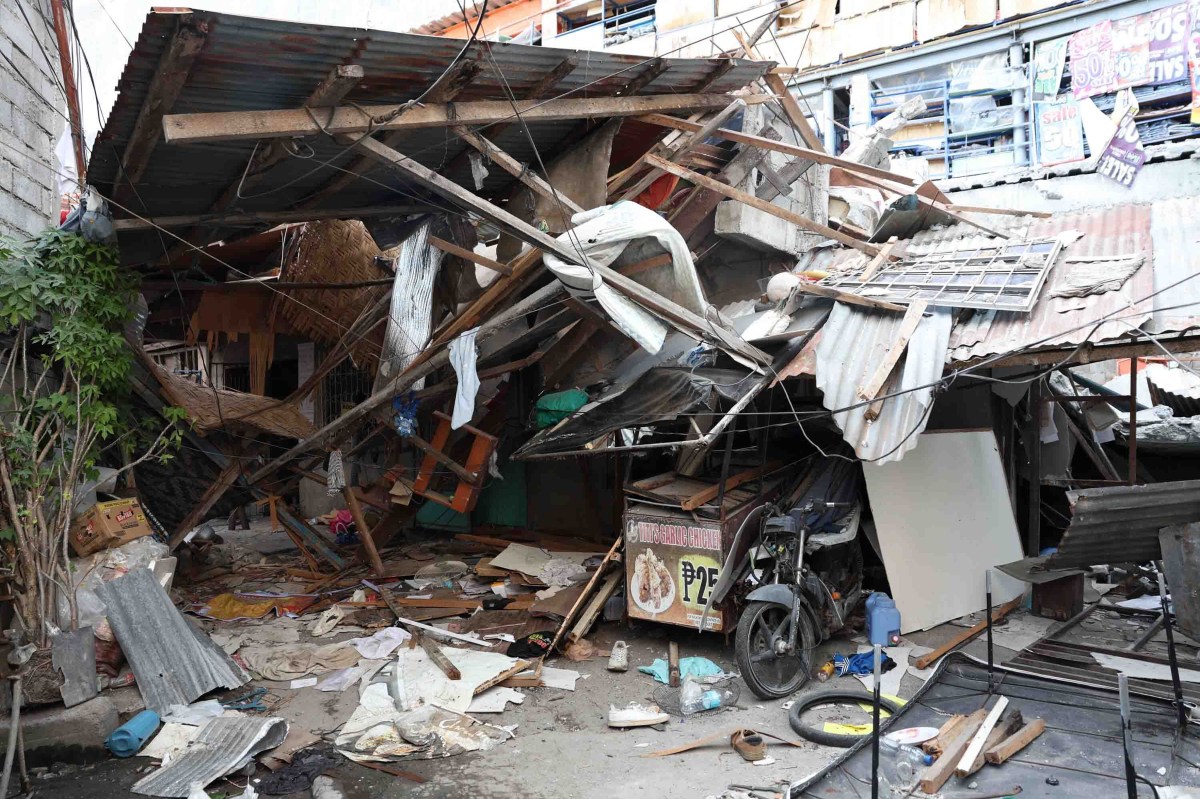
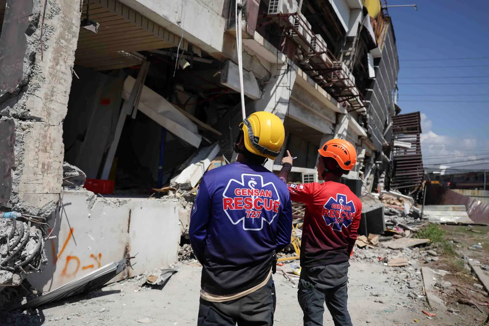
The new shaking comes as communities continue to assess damage from last week’s devastating earthquake, which killed at least 37 people and displaced an estimated 20,000 others. That massive temblor triggered tsunami warnings, collapsed buildings, and caused significant “coastal uplift”—a geological phenomenon where tectonic movement forces coastal land upward. In some locations, the country’s environmental department reported that shorelines extended by up to 65 feet, exposing long stretches of coral reefs and seagrass beds.
Seismologists warn that the region is tectonically active and has a long history of major earthquakes, with dozens of magnitude 7 or larger quakes recorded within a few hundred kilometers over the past century.
The ongoing aftershock sequence raises immediate concerns about landslides, disruptions to recovery efforts, and the potential collapse of structures already weakened by the initial quake.
The Latest Earthquakes
According to USGS data, the most recent quakes recorded in the past day include:
- Magnitude 5.1–16 miles (27 km) SE of Magdalena, Philippines
- Magnitude 5.2–32 miles (53 km) ENE of Hinatuan, Philippines
- Magnitude 4.6–41 miles (66 km) south of Sarangani, Philippines
- Magnitude 5.0–20 miles (33 km) ESE of Sarangani, Philippines
- Magnitude 4.8–3.72 miles (6 km) ESE of Butulan, Philippines
A Region Primed for Seismic Activity
Earthquakes are a regular occurrence in the Philippines due to its location along the Pacific “Ring of Fire,” a vast, horseshoe-shaped zone of fault lines and volcanoes surrounding the Pacific Ocean that accounts for about 90 percent of the world’s earthquakes.
The Philippine archipelago sits in a complex tectonic zone where the Philippine Sea Plate and the Eurasian Plate converge. As these massive plates shift, one is forced beneath the other in a process known as subduction, causing stress to build up along underground faults. When that stress is suddenly released, it generates seismic waves.
According to the USGS, the magnitude 7.8 quake on June 8 was caused by thrust faulting linked to subduction along the Cotabato Trench, a major earthquake-generating structure off the coast of Mindanao. This volatile tectonic setup explains why the region is uniquely prone to tsunamis, landslides, and volcanic activity.
How Should Residents Prepare for Aftershocks?
Experts say aftershocks will likely continue for days or even weeks as the Earth’s crust adjusts following the massive June 8 rupture. While most daily tremors are too small to be felt, some aftershocks can still be strong enough to cause additional damage.
Local authorities have urged residents to remain cautious, avoid damaged structures, and stay alert for official advisories—particularly in coastal or landslide-prone areas—as the region navigates a long and precarious recovery.

Read the full article here


